Good Saturday to one and all. We have a fantastic weather weekend in progress across the bluegrass state. A blast of summer temps will combine with sunny skies to make for back to back days of the good stuff. While everyone is focusing on the nice sky, my focus is fully on the severe weather threat into early next week.
Let’s set you up with the good part of the program. Temps today will range from the mid 70s in the north to the low 80s in the far west and south. Skies will be mainly sunny. Most areas will make a run at 80 degrees for Sunday as we hang on to a gusty southwesterly wind.
Late day thunderstorms will be possible across the western part of the state. This is the first round of a multi-day outbreak of strong and severe storms impacting our region. The prime time for severe weather looks to be from Monday through early Wednesday. Here’s the setup I see…
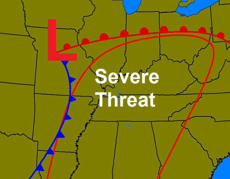
Damaging winds, large hail and tornadoes are all possible during the first half of next week. That is something for us to keep a VERY close eye on as we roll forward.
This is a potent storm system that will slowly move from the plains into the Great Lakes next week…
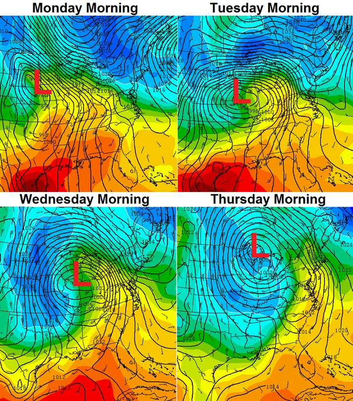 Chilly and showery weather will follow in behind that for the end of the week. That could make for some ugly weather for much of the area.
I will have updates on the severe threat through the weekend. Enjoy your day and take care.

Thanks for the updates, I appreciate them even if it’s not good news. Severe weather with the mention of the word ‘tornado’ scares me and brings up a memory I’d rather forget. Praying that the severe weather threat dwindles and goes away completely.
Thanks Chris. Looks like a typical Derby week weather wise. At least we have a gorgeous weekend on tap first! I think I am going to have to.buy some waders for work though. Our parking lot gets a lot of standing water in it with heavy rain. Not looking forward to any severe weather but it comes with the territory, I reckon. Hope everyone goes out and enjoys the day! It’s a great day for spring football! Have a wonderful Saturday everyone! Thanks again Chris.
Why do I have the strangest feeling this is gonna be something like March 2nd 2012?
Chris please tell me this is no March 2
Nobody can promise you anything when it comes to weather. :/
I don’t think I asked him to promise me I just once like to comment without someone coming back with a smart answer Chris I used to love this blog but now I think I just watch you on the tube…..
Some folks just get a kick out of getting others riled up Marsha just ignore them
Thanks Andy its just these storms really scared me still I’m getting a little better with them but still have a long way to go march 2 2012 I will never forget
It mostly likely will be your garden variety spring storms it won’t get to out of hand
Andy if you’re referring to me, you are making a false accusation.
Marsha that comment was not called for. I was not giving you a rude remark.
At least it’s decent wx today 🙂 . Currently 81 here in Nashville with a mix of high clouds and sunshine. Currently 80 in Louisville, if more cloud cover.
– – – – – – – –
But not-so-good news from the Storm Prediction Center. The SPC already has a Moderate Risk of severe wx on Monday for western Tennessee – and for all practical purposes this includes counties in far western Kentucky near the TN line. The rest of KY and TN remain under a Slight Risk for Monday, at least for now.
Also, the Weather Prediction Center (WPC) has a slight risk for excessive rainfall for western parts of KY and TN tomorrow. Due to the relatively dry conditions as of late, hopefully the soil will soak up much of the heavy rain the next few days, but some isolated flooding issues can’t be ruled out.
The severe wx threat for KY and TN on Monday and Tuesday is still a ways off, so as we know the models can and likely will adjust between now and then. However, much of Arkansas could have an outbreak of large and long-tracking tornadoes tomorrow (Sunday), so please inform your friends and relatives there of this danger!
I’m praying for all those people don’t want to see anyone get those storms
Geez Marsha, relax lol…the odds of getting shredded by a tornado are ridiculous….Find something else to worry about.