
Good evening, folks. Waves of heavy rain continue to target our part of the world, bringing an overnight flood threat across southeastern parts of the state. The more widespread show arrives Wednesday into Wednesday night and could bring a few strong storms with it.
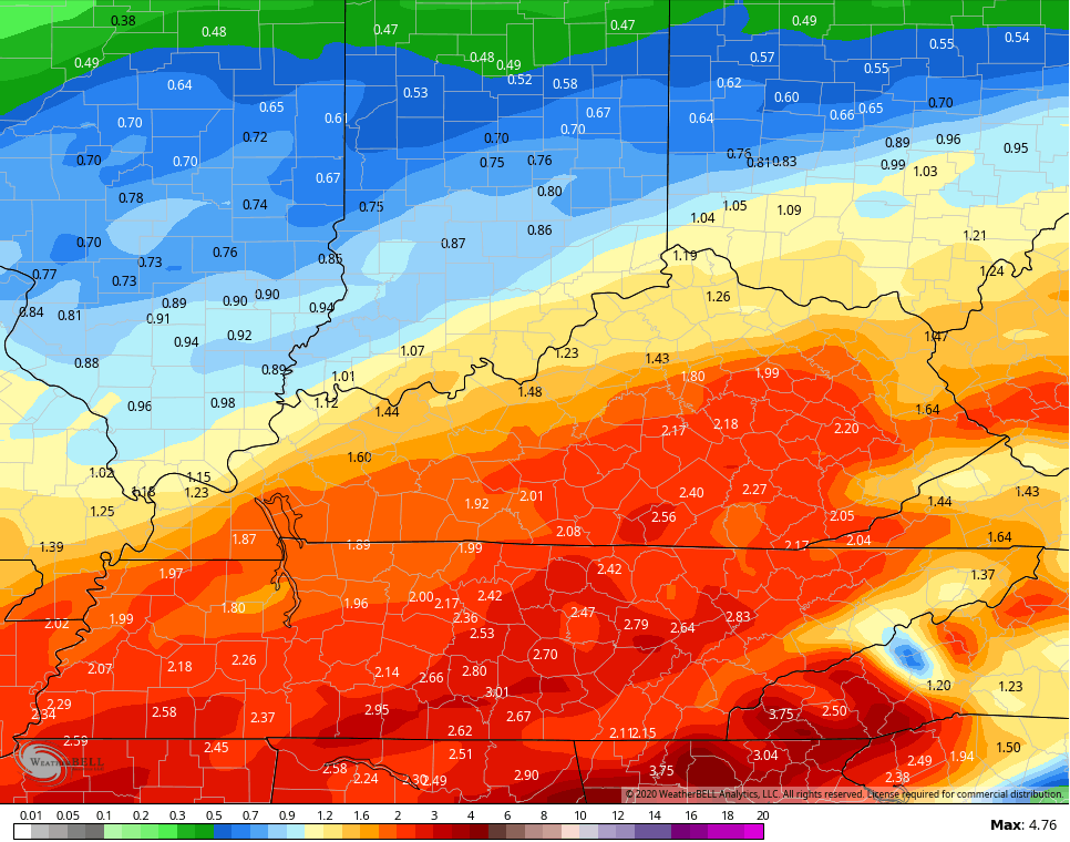
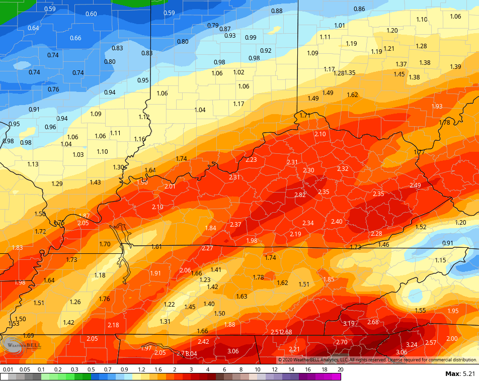
Many areas have already picked up well over an inch of rain on the day and we have quite a bit more to go through over the next few days. We’ve had some minor high water issues across areas all the way north to Interstate 64.
The current flood watch through early Tuesday continues to cover only a few counties in the far southeast…

Another round of heavy rain moves in overnight and early Tuesday, then a break shows up. That won’t have a long shelf life as more heavy rain and thunderstorms move in for Wednesday and Wednesday night. Here’s the additional rainfall from the models…
NAM
 GFS
GFS
 The threat for severe weather on Wednesday hasn’t been updated since earlier…

Here are the trackers for the rest of the evening…


Have a good one and take care.
So far, the good Lord may be answering prayers as today’s rain is coming in the under in SE KY and was heavier farther NW in areas that don’t need it but not nearly as saturated as down this way. The Deep South really sucked the heavy moisture from this first system. If (big question as Wednesday ‘s system looks rather impressive to me), the amounts only average 2 more inches and change areawide, I think we escape with the only minor flooding as the we can take a few inches more spread out. I still think the numbers may be higher IF t-storms get into the mix Wednesday but we wait and see.
Ignore the extra “the” in the sentences, lol. Phone typos 😛
This might be the 4th straight February to finish in the Top 10 warmest in Lexington—2017, 2018, and 2019 all already there. What do they all have in common? A ton of rain. Also, we never had winter this year. This will wind up as the 2nd or 3rd warmest winter ever in Lexington following a warm 2019. Looks like warmer and much wetter than normal is here to stay!