Good Monday, everyone. Today’s the day we honor those who have given the ultimate sacrifice for our beloved country. It’s also a holiday where a lot of folks take to the outdoors to unofficially kick off summer. The recent string of nice weather days is giving way to an increasing risk of showers and thunderstorms.
Highs today will generally run from the low to mid 80s with muggy conditions and scattered showers and storms going up. Regional radar is your BFF for the day…

The threat for showers and storms will be around each day for the rest of the week. These are likely to contain very heavy rain that can lead to local flash flood issues on any given day. One or two of those could be on the strong side.
I’m becoming more and more convinced we aren’t going to have a shortage of rain chances as we head through most of the summer. June is especially taking on a rather damp look for much of the country. Check out the new CFS rainfall forecast through the first week of July…
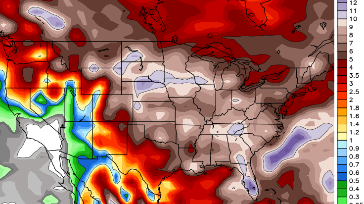
That’s a wet signal for much of the central and eastern part of the country and also argues for normal or slightly below normal temps during the same time period.
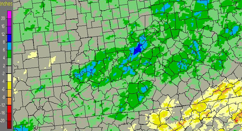
This basically is a continuation of the above normal precipitation pattern most of the state has been in for a long time now. Check out how far above normal most areas are since January 1…
 Have a great holiday and take care.

Humid is back today, going to be a tropical rain forest type of pattern the way it sounds Chris! Swiming pool folks should be happy!
The mesonet site out of Harlan Co is reading 10-20 degrees cooler than anywhere else it seems like for the past week. Surely there’s no truth to that?
I do see some below normal precipitation showing up in southeast KY.