Good Sunday and welcome to the month of June. This is the first day of summer for those of us in the weather world and it certainly is feeling the part. You will notice a big increase in humidity levels as the day wears on and this is just the tip of the iceberg. That iceberg may be needed to cool you off this week as the atmosphere is loaded with warm and humid conditions.
That’s not the only thing loading up… rounds of thunderstorms will really gear up over the next week and change. I know the stuff last week didn’t turn out to be as widespread as it could have, but this is a different setup. If you don’t believe me, just step outside in the coming days. 😉
The threat for scattered storms blows back in from southwest to northeast today. Track away…

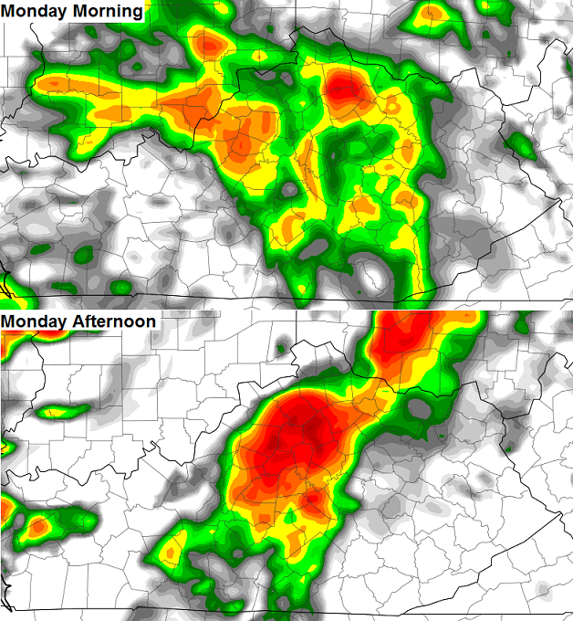
The storms for Monday look to be a bit more prominent and that shows up well on the high res NAM simulated radar…
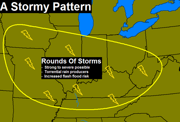
 All of this is part of a pattern that is likely to turn very stormy as the week progresses. Here’s what I’m expecting…
 The models are all pointing in this direction and we’re really going to have to keep a very close eye on the rainfall numbers. The European Model rainfall forecast…
 Check out the amount of real estate forecast to get a lot of rain over the next week and change. That’s pretty impressive.
Have a great day and take care.

Already looking forward to October.I know…we have some heat lovers but I am just not one of them.
Mowed my lawn today and it felt a little to warm for me but been reading the coming forecast and figured today would be the best day to be outside for awhile.My thermometers are on covered porches and they were pushing 90 on Saturday but the humidity was low thankfully.
Was really hoping to have a month or two without AC running since the winter heating bills socked me good.But over all it could be so much worse so I will try not to complain to much.Thanks Chris.I read on the page everyday even if I don’t post.
Thanks Chris. Yesterday certainly was a perfect early summer day! It was a great day to be outside doing anything. Of course the summer season coming on does bring heat and humidity, and some scorchers. But at least you are not talking bone dry. Just going yo take them one day at a time and go with the flow. Have a great Sunday everyone.
No rain in my area of Frankfort in 10 days, hopefully some is coming soon!
It’s almost funny (odd) that map leaves us out again. Thanks Chris!
I had to turn the sprinklers on yesterday.