Good Saturday, folks. Another stormy pattern is kicking off across the Bluegrass state and this will carry us through the majority of the next week. Some of these storms will put down a lot of water and I can’t rule out a few strong boomers.
Western Kentucky will be the first area to see the storms this afternoon and early evening. We will have to watch for a cluster of strong and severe storms rolling into this region from the west. The flow should then bring that swath of showers and storms eastward across the rest of the state…
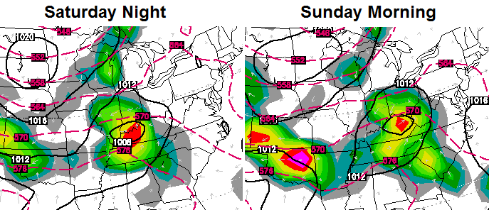 Heavy rainfall could lead to some local high water issues. Rounds of showers and thunderstorms will be common through the middle of the upcoming week. Here’s the setup…
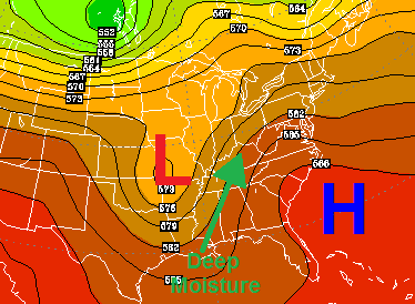
That flow will lead to the potential for additional heavy rains to fall from the plains through the Ohio Valley…
 I will leave you with all the tools you need to track storms in from the west…
Today’s Risk Area

Current Watches

Possible Watch Areas 

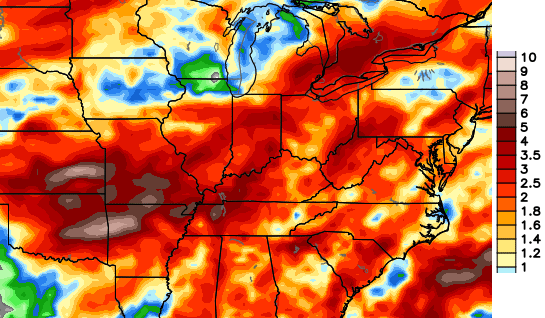
Rainfall Since Midnight

Have a great day and take care.

Wouldn’t be surprised to see that complex move all the way through EKY by early tomorrow morning. Central ky could see a few strong storms out of it.
On the NWS, the forecast for tonight is 40 percent for thunderstorms, but tomorrow, it went from thunderstorms to just “showers”
If the frankfort pattern holds true this will be a fading batch of storms as it reaches frankfort, going on 3 weeks with less than a half inch of rain in my yard!
or it does the splits.