Good Friday, to one and all. We’ve mad it through a stormy and cooler than normal week across the bluegrass state. Things are still a bit stormy today as a cold front works through here. This will unleash a cool brand of air that could send temps to near record lows by Saturday morning.
Today’s front has a decent amount of moisture to work with… especially early in the day. This will aid in the development of scattered showers and storms. Storms could be a little feisty with heavy rain and lightning. Winds will really crank up behind this front as cooler and drier air moves in later in the day.

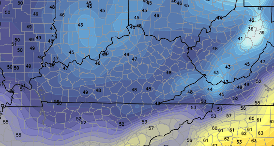
Current temperatures

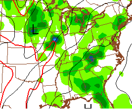
Winds

That sets the stage for temps to take a dive overnight. Check out the GFS forecast for lows…
 Those are some seriously cool numbers for this time of year and a few record lows may be in jeopardy. The rest of Saturday looks great with sunshine and mid to upper 70s for much of the region.
Temps early next week will try to ramp up a notch and will surge well into the 80s and may threaten 90 degrees. Higher humidity levels will give us much more of a muggy feeling and will likely help to fire up some storms…
 Showers and storms will try to keep temps from reaching 90 degrees for the first time this year for areas of Kentucky not named Paducah. Any days that features more sun will have the best shot to deliver a typical summertime 90 degree reading.
There is a bit of disagreement among the models for the second half of next week. The pattern suggests another cold front approaches from the northwest with additional showers and storms. That’s just what the GFS shows…
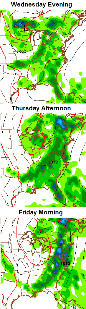 The model is likely overdoing that front as there is a lot going on with the upper air pattern across the country. We could easily see that shot aimed more to our west, instead.
Enjoy your Friday and take care.

Good write-up on 90 degree climatology for Kentucky.
http://www.crh.noaa.gov/news/display_cmsstory.php?wfo=lmk&storyid=102823&source=0
Ahh, yes….2004 was so wet & stormy. No wonder it didn’t hit 90 once that year.
Small area of moderate drought has appeared in far southeast KY.
http://droughtmonitor.unl.edu/Home/StateDroughtMonitor.aspx?KY
I wouldn’t be to overly concerned about any drought situation with the pattern that were in that sliver in SE KY will get rain.
The pattern has been over predicting rains that haven’t fallen in lots of areas, an expanding drought would not surprize me in the coming weeks!
You said this same thing last year… our 3rd wettest summer on record.
My area of the world is in a weird zone that receives less rain every summer, don’t know why Chris but it is a pattern I have noticed for years??
Franklin County summer rainfall (June, July, August).
2009: 13.43
2010: 11.50
2011: 12.64
2012: 9.22
2013: 18.58
That’s not east Frankfort!
West frankfort has measured 4 more inches of rain in the last two weeks than I’ve have got?
Maybe you should move? 🙂 I kid, I kid.
I know right!
I agree parts of Knox got drenched yesterday 1.38 some parts got .01 and the way its starting to feel atm it wouldn’t surprise me to get it again.
The drought monitor has only been around for a few years, now. It was designed to show drought where there really isn’t one. The Palmer Drought Index is a much better tool. “Drought” is the most misused term in the comments section.
This is an interesting old Palmer map. I’d not want to see this again…
http://www.cpc.ncep.noaa.gov/products/analysis_monitoring/regional_monitoring/palmer/1999/09-25-1999.gif
Here’s some other misused words in weather. Polar Vortex, Global Warming and Humidity. You watch and see this winter when a sharp cold front moves on through and drops the temps drastically the media will say here comes the Polar Vortex. (Global Warming) enough said no need to start that conversation up. Humidity gets overused dewpoints is much more relevant.
Yep… now THAT was a drought. Brutal.
Here is the current Palmer drought index
http://www.cpc.ncep.noaa.gov/products/analysis_monitoring/regional_monitoring/palmer.gif
Not enough rain to wet the roads at my place today, sun is shinning brightly now in east Frankfort, nice afternoon!
It feels glorious out right now.