Good Saturday, friends and neighbors. Our weekend is kicking off on one of the better weather notes we will have of the entire summer. Pleasant temps and plenty of sunshine will rule the day. Unfortunately, this isn’t going to last as a steamy air mass works in later Sunday.
We may start this day out with record lows from the upper 40s to near 50 degrees. Follow along…
Today’s Lows

Current Temperatures

Highs this afternoon will reach the mid to upper 70s with low humidity levels and sunshine. Go out and take full advantage of a day like this.
Temps for Father’s Day will warm into the 80-85 degree range for most of the state. Humidity levels increase and I can’t rule out isolated showers and thunderstorms.
Temps into the first half of next week will head toward 90 degrees…
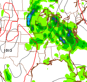
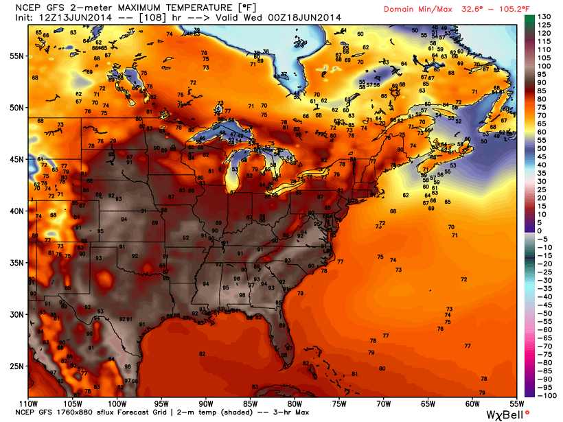 Scattered showers and thunderstorms will develop into the heart of the afternoon hours each day. That will have an impact afternoon highs. A day that features mainly sun where you live will likely hit 90 degrees. Any day that features afternoon storms won’t. Sometimes it’s that simple.
The threat for storms will increase late next week as a weak front slides our way from the northwest…
 As I said… enjoy the day.
Take care.

Thanks Chris. I am going to enjoy today, as soon as I get off from work! 🙁 Ah well I get off at 3 so there will be plenty of daylight left to enjoy! Love this time if the year. Here’s wishing everyone a wonderful Saturday! Thanks again Chris for keeping us updated. Even when you are off the screen!
How about a map citing all of the record lows set last night? I’m sure some places had one, even if Lex only made it within 5 degrees of tying its own record.
Today feels great, but honestly it’s just going to make what’s coming feel that much worse when it arrives.
Richmond was low 50s this morning.
It was 47 in Frankfort this morning–the record was 43.
Covington missed tying the record low for today (46) by one. Close but no cigar.
TWC is showing highs in the low 90s next week, ouch!
I hope they are wrong, mid 80s is hot enough for me!
My kind of summer day. Pleasant temps, dewpoints in the 40’s and 50’s, sunny skies. Too bad the muggies are about to return!