Good Monday, everyone. Typical summer heat has finally arrived in the bluegrass state and will hang tough for much of the week. The toasty temps will be accompanied by an increase in humidity and thunderstorms. The thunderstorm part of that really ramps up later in the week as we transition toward some cooler air.
Today will feature a mix of sun and clouds with isolated showers and thunderstorms. All of this will keep temps into the upper 80s to around 90.

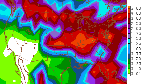
Current temperatures

Tuesday and Wednesday should feature more sunshine and less of a storm chance. That means temps of 90 or a few degrees better will be a good possibility.
The threat for boomers increase after that…
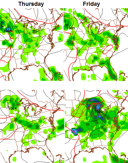
Watch how the GFS takes us from a heat ridge to a nice little trough during this time…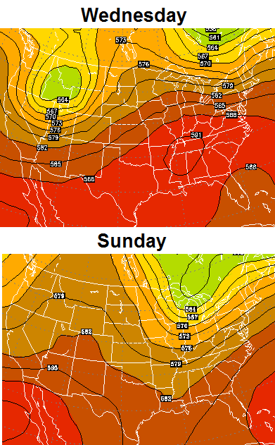
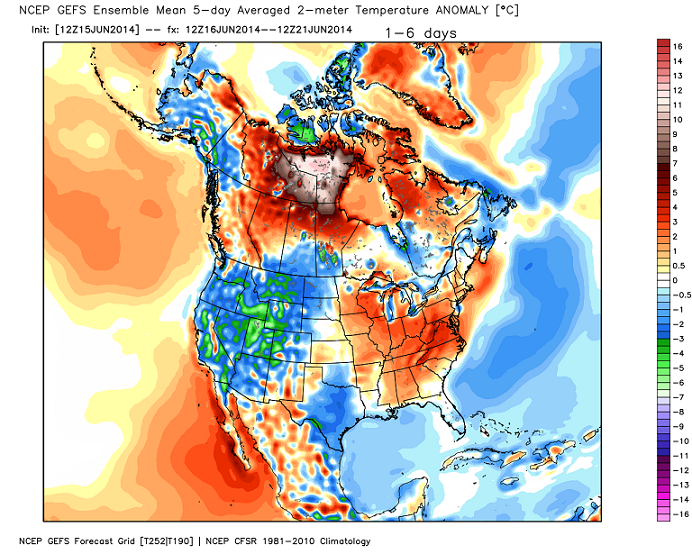
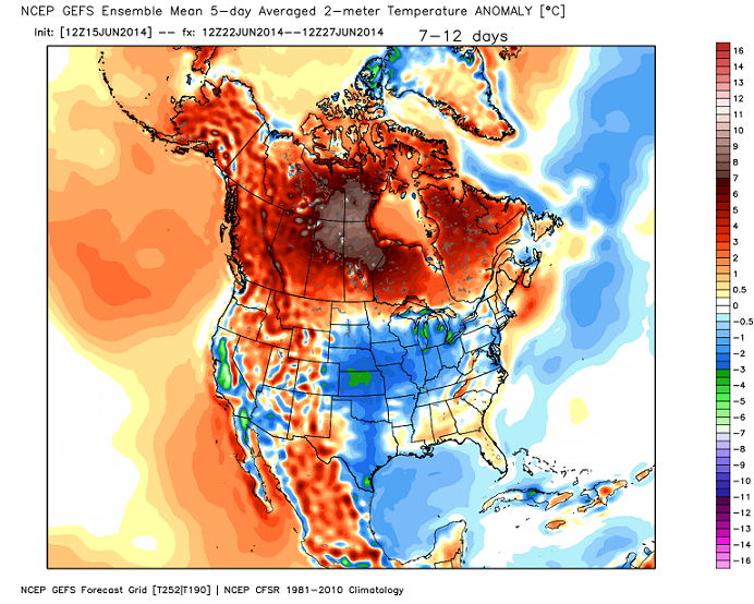
The GFS Ensembles are picking up on something similar taking place. Check out all the cool air in the west and how it bleeds in here over the next few weeks…
 That pattern could mean the storm train fires back up from the plains into the Ohio Valley through the next 2 weeks…
In the meantime, let’s enjoy the summertime heat. Speaking of, let’s go old school for some tunes…
Admit it… you’re jamming with it. 😉
Take care.

Thanks for the tunes! Have a great day!
I went to different parts of Canada during the summer several times over the years when I was a kid. It was always a lot nicer weather-wise than it was back here in Kentucky. Every temp map the last several summers, it seems to show Canada consistently baking instead.
“…and if it ain’t broke then don’t try to fix it.”
Indeed Will, indeed.
http://youtu.be/Kr0tTbTbmVA
Evil clipboard cache!
http://youtu.be/AYOJX-fuKqM
Thanks Chris. Wouldn’t you know it….I am off this Saturday and it looks like if will be raining…oh well. Still, the weather is about what it is supposed to be for this time of year, so I will take it and run with it!
Have a wonderful and safe Monday, everyone!
Ugly feeling outside in east Frankfort, dew point 69, temp 87, heat index 91!
Saturdays weather a distance memory already! Ugggggggg
Some old old school 😛
http://www.youtube.com/watch?v=_NVVe1DkVsQ
looks like Ohio hogging the rain today, not a SURPRIZE, if you get rain in KY today you are blessed!
#Blessed
Thanks CB for starting the summer musical theme! Seems to help some of us survive a Monday slaving at work.
Here’s…..
http://www.youtube.com/watch?v=zc9wIzi96_E
Hey, you copied What I was going to put haha.
First time of the summer there have been widespread lower 90’s. Lexington was 89 at 3:00; Louisville has hit 92. Dewpoints are high, but not as bad as they could be. I seem to remember some Upper 70’s and Lower 80’s dewpoints in July of 2011.
Chris Mercer spot on with that 92 degree high in Louisville. Louisville might eek out at 93 before all said and done. A/C getting a workout today been running non-stop.
I can easily put up with more days like this..
I need to find out more about the twin tornadoes this evening in Northeast Nebrasksa. The short videos I just saw on the news were amazing!