Good Wednesday, everyone. Our broken record of a forecast keeps on keepin’ on with rounds of showers and thunderstorms on the way. I get some of you haven’t had a lot of rain in recent weeks, but we have had no shortage of rain chances. Those chances don’t look to go away anytime soon.
We have a wave of low pressure working to our north and east today. This will give us scattered showers and storms across the central and east early in the day. Increasing amounts of sun will develop from west to east with highs in the 80s.
Current temperatures


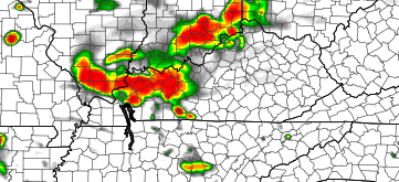
That front will put the brakes on and hang around the bluegrass state into Thursday. That should allow for additional showers and storms to ramp up during the afternoon and evening. Check out the NAM simulated radar by the afternoon…
That’s a trend that is likely to carry us into Friday and the coming weekend. This is a big weekend for NASCAR fans heading to the Kentucky Speedway on Saturday. Unfortunately, the setup is ripe for scattered storms to be around in a very muggy atmosphere.
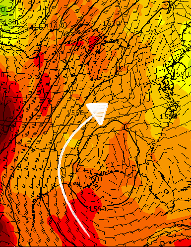
Our flow this weekend is coming straight out of the Gulf…
 That means rounds of strong storms will torrential rainfall will be a good bet this weekend into early next week.
Enjoy the day and take care.

hey good work of late Bailey as well as Jimmy and Micah
It’s not rolo season?
Nice little popup shower in east frankfort a few minutes ago, the humidity is rocking still in my area, but rain is nice!
You can feel the difference between a lower 60’s dewpoint and a lower 70’s dewpoint here in Lexington today.
Love this weather.