Good Thursday, folks. June is quickly running out of days and this means the 4th Of July will be here before we know it. Will the old adage “hotter than the 4th of July” prove to be correct this year? I have a peek at how things try to play out next week.
Before we get there, let’s talk about what we have going on in the short term.
Temps today flirt with 90 in the west and hit the mid and upper 80s elsewhere. Scattered storms will develop during the afternoon and evening hours.
Most areas try to tickle 90 degrees on Friday with a few rounds of showers and storms going up. Those showers and storms continue into the weekend. That action will increase with very heavy rainfall and the potential for a few strong storms.
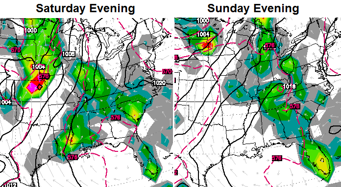
Temps will be in the upper 80s to around 90 before any storms blow up. That same temperature regime looks to hold tough into early next week. Things look to change by the middle and end of the week and that takes us into the 4th of July. The European Model is showing a nice dip in the jet stream…
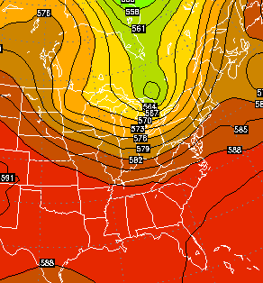
That brings a cold front through the region by Wednesday or Thursday…
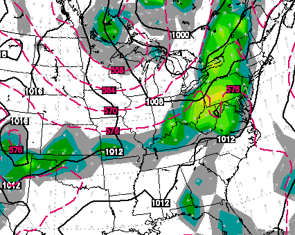
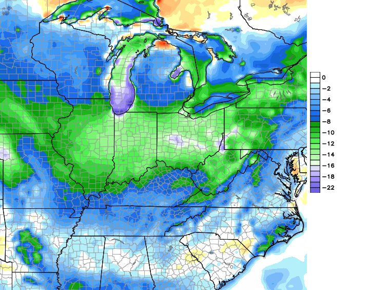
The air behind that for the 4th is of a much cooler nature. How cool? If the European is right, very cool…
 As always, time will tell. Make it a great day and take care.

Im willing to bet that the models are overdoing the cool air once again. This is summer time and we haven’t had any real heat yet and its that time of year to start seeing the hottest air of the season.
What do you consider real heat?
95+ very few areas in KY have only come close to this. Of Course I lived in SE Arizona for 4 years, temps over 100 were common, but we have yet to see any heat that would approach 100. So Im naturally skeptical of models that would show us having any major cool downs this time of year.
Depends on location as we have had a few low to mid 90 days where I am and that is real heat for any place In KY
If your in Louisville they had a streak of 8 straight days of 90 degree temps or better two of those days hit 94 with high dewpoints. Granted its not upper 90’s or 100’s heat but still hot enough.
Sounds similar
Man, I’m all about those greens and blues on the European map!
There have been one to several cool days sometime in the week after the Fourth for as many years as I can remember. It’s a yearly pattern in central Ky, people. HOW cool is the question.
I cant remember any lol
Then again I cant remember what I did a hour ago.
Seems I recall – perhaps over a decade ago – a cold front that virtually made to the Gulf Coast despite it being July; think there were even a few record lows in the deep South.
BTW, like your ‘evodevo’ handle. Are you a biologist?
If the European is right upper 70’s low 80’s at best, thats a big if.
Even that would be a welcome break.
Agreed I sure wouldn’t be upset with high’s in the upper 70’s lower 80’s thats perfection in the temp department. Im just somewhat skeptical of a real cool down this time of year. Hopefully it comes into fruition would be awesome.
I hope Chris is right about the rain this weekend, we could use more in my neck of the woods! Muggy morning in frankfort, yuk!
The Euro doesn’t have to be correct on the temps, it just needs to follow through on what should be drier air. Normal temp is 85 as of today, so unless it’s more than a couple of degrees cooler, it won’t be noticeable without the drier air.
And as far as temp model maps, UK Blue is always a desirable color.
I agree with LD. Is the apocalypse coming?
CB, you know as well as I know its Louisville’s 747 jet airplane’s coming and going on black asphalt heat island affect. I dont question the accuracy of the thermometer I question where the thermometer is located at a busy airport. Its 91 degrees on the run way right where the official temperature reading is kept as large UPS planes come and go all day long, im sure of it lol. It’s a joke always has been local mets have complain for years on this issue yet nothing gets done. I cannot understand why the official temp cannot be taken at the NWS must be politics involved. Winter time they take the official snowfall total at the airport how does that system even work accurately? It doesnt, much like the temps, zero logic.
It makes no sense to have a thermometer in an area where so much unnatural heat can be generated. Yes the temp should reflect the area temp as a whole but the actual instruments should be located elsewhere. Just wondering how the data collected from this station and others placed in similar predicaments have skewed weather data over the years thus contributing to the sketchy science at best used to justify claims of “Climate Change”