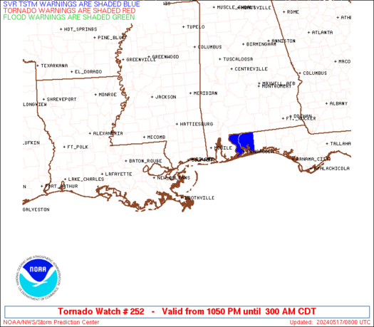
The threat for severe storms is ramping back up again across parts of the state. A SEVERE THUNDERSTORM WATCH is now out for the southwestern Kentucky. Here is a look…
The latest warnings…
Damaging winds and hail are the main threats in these areas. There is also a line of storms trying to crank just north of the Ohio River and this line may settle southward in time. Track all the storms here…
Take care


this is wonderful. once again we miss out on all the action. 🙁
in the long term, the 12z gfs was showing several derecho possibilities this weekend going into next week.
woohoo on missing out
The rain i dun mind severe weather i don’t want
We’ve had a few 5 minute showers over the past couple of days, but the ground is rock hard and the grass is already burning out here in Georgetown. It’s either feast or famine in the rain department anymore.
These storms sure did pop up quickly here in Ravenna. The lightning was unreal and we had a hard rain. Some wind, but thankfully no hail.
I think lightning is my favorite part of a storm. I know it’s dangerous and can cause damage but I love watching it.
personaaly, i think hail is the best part, but lightning is EXTREMELY awesome.
Had a big black cloud pop up right over my house in Winchester. Wind kicked up and I got all excited and nada. No lightning, no rain, nothing. And now the sun is back. How depressing 🙁
rain to my north, south, east, and west…and finally i think I might get a good soaker and it scoots to my north pounding north knox co. with torential rain..and all i got was a few sprinkles….LORD OH LORD MY YARD NEEDS RAIN….
Hahaahha. Im not too bright today. Great post!