Good Wednesday to everyone. The weather pattern is once again threatening to go all out toward a stormy and very wet one for the rest of the week. This much has been talked about before… the thing that is getting my attention more and more is the chance we only get a small break from it this weekend before it returns in more widespread fashion by early next week.
In the short term… we will watch a cluster of strong and severe thunderstorms rolling eastward out of Missouri and Illinois early this morning. This cluster will take aim at northern Kentucky and bring with it the chance for severe weather and torrential rains. We have to watch for the possibility of these storms “training” from west to east. If that happens… a whole lot of rain may fall in a few areas. Farther south… storms will be more scattered and you can track all the action here…
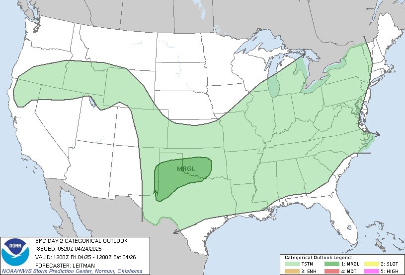
As I mentioned.. the threat for severe weather is with us today… especially across the northern and western parts of the area. Here is the latest severe weather information map from the Storm Prediction Center…
Thursday looks to be a VERY warm and humid day as a cold front makes a run at us from the west late in the day into early Friday. This unstable airmass will also have the potential to produce severe thunderstorms across much of the area. The SPC has a large chunk of real estate around here in the threat area…

The front will actually push through here on Friday and should carry more showers and storms with it. From today through Friday… parts of the area can easily pick up a couple of inches of rain… especially across the north. This could lead to some local high water concerns at any given time and is something we will be watching for.
That front pushes JUST to our south by Saturday. This should allow for clearing skies and cooler and less humid air for about a day and a half. By later Sunday… clouds will rapidly increase as showers and storms approach from the southwest as the front moves back north. This time… it should be accompanied by a slow moving low pressure that may move right on top of us for Monday and Tuesday. This has the potential to bring a round of significant rains to much of the area to go along with the strong storms.
Here is how the GFS sees it…
Monday Morning

Monday Afternoon

Monday Evening

So… you can see where we have some cause for concern over the next week or so as the threat for heavy rains and severe weather will be with us on several occasions.
I will update today’s threat for storms and heavy rain as needed so be sure to check back. Take care.


Northern KY about to get some heavy rains.
Looks like this week may be very …..busy.
Thanks, Chris, for this info. Hope we are spared the severe weather, but it’s always good to know we have this blog to go to for preparedeness.
Severe Thunderstorm Warning just issued by Louisville.
Really coming down in Gtown
back about so many things that we had wanted to do in life together but hadn had the time or money to do it Would our dreams just remain so or would we still have time to go through them The physician office called in again to say that there had been some confusion and the call was meant for the next person God was this how god had meant to be handbags fake gucci wallets That was when I went shopping at the RH store and bought myself Louis Vuitton