Good Monday evening, all. Windy and mild weather is with us to start the week, but the end of the week looks much different. We are about to head into a very wintry pattern for November and that means colder than normal air and the threat for more snowflakes.
Rain moves in from west to east late Tuesday into Wednesday. A much colder system dives in behind this for Thursday. That could lead to some wet snow mixing in by Thursday night into Friday.

Another system swings in late Saturday with gusty showers. The air behind this is a little colder, so that means a slightly better chances for some snow showers or flurries…

These maps look an awful lot like the heart of winter…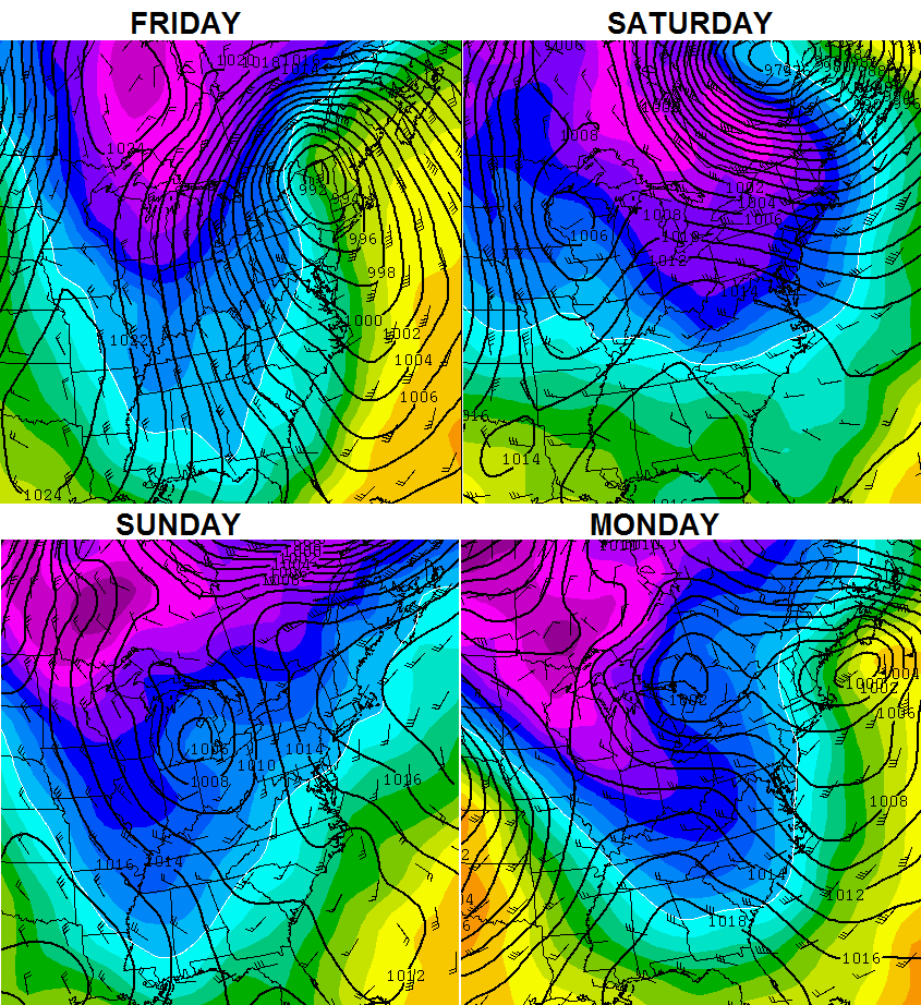
Next week is when arctic air tries to get involved…
 That could send much of the eastern half of the country into the deep freeze! Old Man Winter is getting started VERY early this year.
I will have a full update late tonight. Take care.

I’m in CB!
Looks like the clipper systems we get in January..
Almost 70 in Lexington today. I was surprised by how warm it was.
Brrr!!!!! Chris I knwcyou say what you see so we can be prepared but I have to tell ya I’m NOT ready for this just yet, unless it can mean a good snow a little later in the season. (Preferably when it’s actualky winter!)
Bring. It. On.
Would love to get some snow. We’re getting outdone by Columbia, SC in the early going. 😉
It should be interesting as typhoon neoguri recurves. It has a 923 mb low over the Aleutians islands by November 8. Translate that out 17 to 21 days and we may be dealing with a MAJOR storm on the east coast or ohio valley around thanksgiving. And with all this cold air coming down would not be surprised if it intercepted this storm. Let the fun and games begin…
The last maps with the neg numbers,
Are those neg temps the departure from normal temps
Or is that the actual lows it is predicting?
Thx ahead of time, I’m a wx newby
Lol
🙂
Look like they’re forecast temps in Celsius. -10°C is 14°F. If it was Fahrenheit, forget about it, it’d be unprecedented. If it was departure normal in °F, then that’s not as cold as we just endured this past weekend. But if it’s departure in °C, then that’s like 20°F below normal, which is also reasonable.
Thank you Israel!
🙂
Looks like we will need to put
Another log on the fire next week.
Your welcome, now bring on the Arctic air if that’s the only way it could snow around here! 🙂