Good Wednesday evening, gang. It’s that time of the day for your friendly weatherdude to drop by for a quick update on the upcoming pattern. We have a lot of cold on the way and the first round blows in later Thursday.
This comes behind a fast moving cold front that sweeps eastward across the state with falling temps. It could get JUST cold enough for a few snowflakes to mix in tomorrow night and Friday morning…

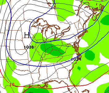
That’s a quick hitting system that scoots to our easy by Friday afternoon. It will make way for another quick hitter moving in later Saturday into Sunday. That one could also throw a snowflake our way by Sunday morning.
The main action continues to be centered on next week. That’s when temps grow much colder than normal across the country. Watch the progression…
 It’s the middle and end of next week when arctic air gets involved with the pattern for much of the country. That, my friends, is one cold look!
Can we get some snow from this setup? If we can get a split flow to develop, then yes. The new GFS is doing just that…

And a few days later…
A full update comes your way later tonight. Take care.

I’ve already started my propane savings account for all of cold weather to come! Bring on the snow
Just paid the lowest electric bill I’ve had in two years and now here we go! Oh well bring it on!
Just paid the lowest electric bill I’ve had in two years and now here we go! Oh well bring it on!
Just paid the lowest electric bill I’ve had in two years and now here we go! Oh well bring it on!