Good Saturday afternoon, gang. As a chilly wind blows across the bluegrass state, it’s all eyes on the arctic cold coming in the week ahead. This continues to look like a pattern out of the heart of winter and it’s looking like one that will bring snow chances our way.
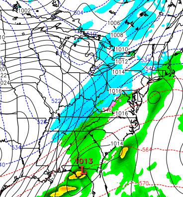
The arctic front swings through here late Tuesday into Wednesday with crashing temps behind the front. The forecast temps on the models will grow colder as we get closer. That means the usual suspects won’t see it until the models do a few days out. The models NEVER handle low level artic well very well and I imagine they will be even worse with this type of air in November.
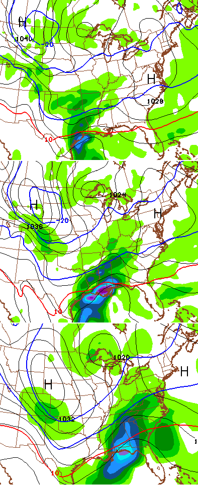
I’ve been talking about watching systems sneak in under the arctic cold and the models continue to sniff those out. The first system that could throw some flakes our way comes late Thursday into Friday. The current GFS continues to show this chance…

The Canadian Model has it as well…
I’m not overly excited about that system bringing much, if anything, our way. The cold will likely overwhelm it, but it’s worth keeping an eye on.
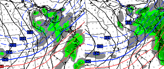
A bigger piece of energy may swing in behind that later next weekend into early the following week. The models continue to point toward a stronger storm system as even colder air dives in behind it. The current GFS…
The higher resolution GFS also shows it…
Again, we are only dealing with the POTENTIAL for some winter weather to join the arctic cold. With such an extreme setup, wild solutions will show up on the various model runs in the coming days. That’s especially true of the European Model in regards to storm tracks and intensity.
Regardless… even colder air is likely to follow next weekend. The pattern and cold over the next few weeks will be a headline maker for much of the country.
Enjoy the rest of the day and take care.

Chris, I think I am going to have to go buy four pairs of work boots after work today! I may need to wear two pairs at a time to keep my feet warm next week and beyond! Thanks for the update.
One has to be in awe looking at the model’s for November..Just hope the cold don’t send all the fluffy stuff south of us this winter..
http://www.tropicaltidbits.com/analysis/models/gfsp/2014110812/gfsp_z500a_us_41.png
With all the cold weather on the way, I hope to enjoy the milder weather we will have for the next 2-3 days. Yard work is on the list and I might go ahead and get my Christmas lights up while the air is mild. Thanks Chris for the looks ahead to the upcoming polar express!