Good Sunday afternoon, gang. Old Man Winter continues to take control of the weather pattern across the country. The upcoming couple of weeks, at least, are taking on a very harsh look across the lower 48. January weather in the middle of November will be making a lot of headlines during this time.
The arctic front will work through here late Tuesday into early Wednesday. The coldest air arrives by Thursday and Friday and the model numbers are trending colder. Highs those two days will be in the 30s with lows dropping into the high teens and low 20s on any night that’s clear.
There is still the chance for a flake maker before the week is over. The Canadian is the most robust with that potential…

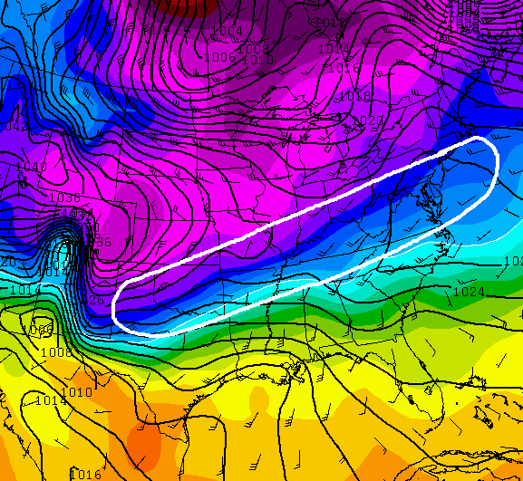
The late weekend system continues to look like it has the potential to be a winter weather maker for a lot of folks and that might include Kentucky. The setup on the European Model is one that would produce a lot of overrunning moisture in the area I’ve outlined…
The current GFS would suggest something similar…
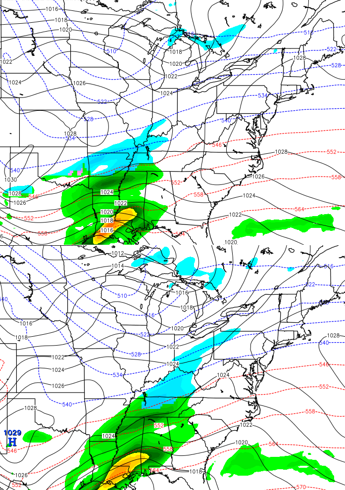
The High Resolution GFS…

What follows all that could be a setup that is much, much colder than the air this week. Check out the HUGE block over Alaska that extends into the north pole…
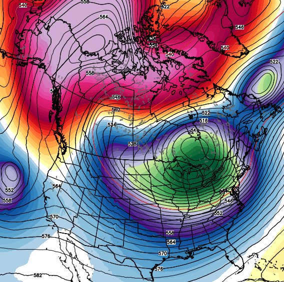
That deep trough sends the country even deeper into the deep freeze…
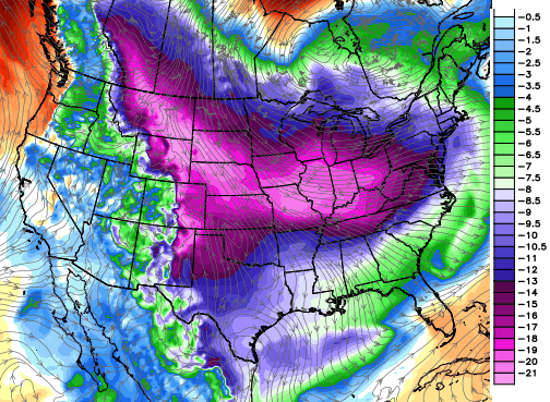
Those numbers are in Celsius and would come out to nearly 40 degrees below normal in Fahrenheit. Umm… wow.
Enjoy the rest of your day and take care.

When will we be able to see the end of this November Polar Express? The models ever since last week have been forecasting this November deep freeze to be even more and more severe. The latest GFS and ECMWF models coming with highs in the 20s for a day or two sometime during next week. Heck, you saw the GFS going below zero in the last post for the following week. Joe Bastardi’s saturday summary saying this will likely be one of the coldest Novembers on record. I mean, look at this!
http://www.cpc.ncep.noaa.gov/products/predictions/610day/index.php
http://www.cpc.ncep.noaa.gov/products/predictions/814day/index.php
As for snow, we have to get snow sometime with all this cold right? Next week looks very interesting….. Thanks a lot Chris, keep the multiple updates comin’!
A repeat of November 1950?
enlighten me. what happened in 1950?
The week of Thanksgiving a huge snowstorm paralyzed much of the Eastern US. At the time, it was the costliest storm on record.
Lexington recorded two straight days with highs in the teens. The low of -3 on November 25 is still a record for the month, as is the snow depth of 8 inches on November 27.
Sports wise, One of the more famous football games was played in the middle of that blizzard between Ohio State and Michigan in Columbus. And undefeated Kentucky lost on a 15 degree day in Knoxville to one-loss Tennessee, 7-0.
My grandparents sure remembered this storm.
So many cars and even trains were marooned north of Knoxville that the military joined civilian efforts to rescue those stranded.
…well, the word “p-a-s-s-e-n-g-e-r” is yet another innocent word that causes the automod to erase posts, probably because of the second, third and fourth letters (I was trying to post “p-a-s-s-e-n-g-e-r train”).
CB, it would be great if the automod could be modified to only disallow real curse words, or even have the offending word highlighted for the poster so revisions can be made before posting.
Is this gonna put a damper on my social activities chris?they are going good soo far.
Is late 1993 one of the analog years?
As a kid growing up in east Tennessee, I have memories of a generally frigid fall and winter period in 1993-94, including November 1993 (and later the brutal Arctic outbreak of January 1994). Who can forget watching on Thanksgiving the Dolphins-Cowboys game at Dallas during that freak winter storm there? Also, who can forget that busted play at the end, the football spinning on the snow, then…….Leon Lett?!!! 😉
Don’t touch the ball Leon. That’s all he had to do.
One of a couple of well known miscues in an otherwise great NFL career, including numerous Pro Bowls. Today, Lett is a defensive coach with the Cowboys.
Wow Chris…..just Wow!