Good Monday evening. What a gorgeous day that’s wrapping up out there. I hope you had the chance to enjoy it because Old Man Winter is on the move toward the bluegrass state. Big temperature changes occur as we head into Tuesday. That’s when an arctic front sweeps in.
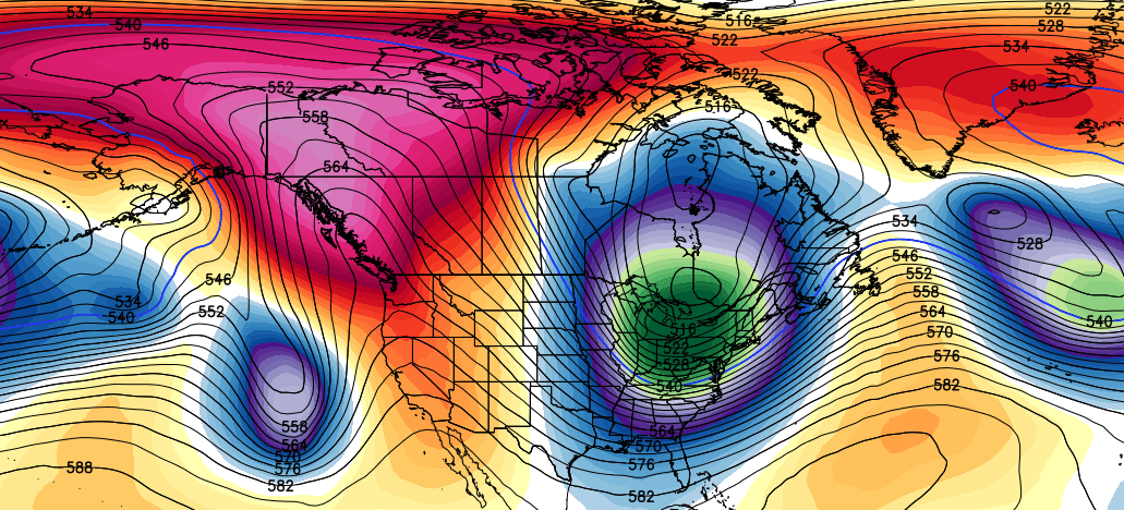
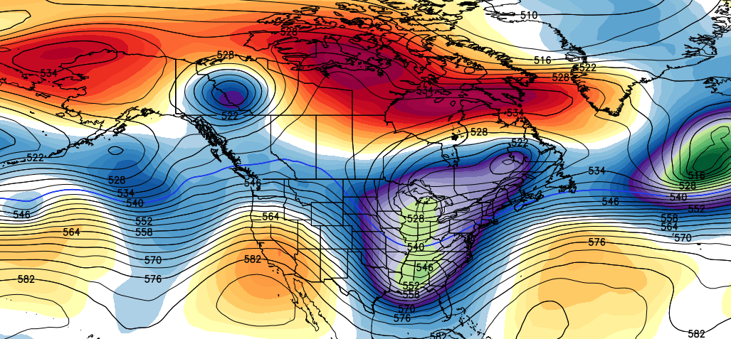
Check out the temperature difference from one side of this front to the other…

The top image is from the middle of the afternoon with the bottom image from late evening. That’s a heck of a plunge that will be accompanied by gusty winds and showers.
The cold behind that digs in for the end of the week and I have no changed with any of that. The weekend system is still on track to bring the potential for some light snow from Saturday night into Sunday. How much, if any, will have to be fine tuned over the next few days. We are in that famous 4-7 day window where the models fumble around.
Another arctic shot will follow whatever flakes we get and that may set the stage for another storm system trying to sneak under that by the middle and end of next week. The European Model is impressed…

The cold over the next few weeks will be nothing short of impressive. Check out the deep trough across our region early next week…
That’s a tremendous amount of blocking showing up and that is leading to the jet stream taking these huge dips. Each dip is full of very cold air and this pattern shows no signs of going away. Here’s Thanksgiving week on the European Ensembles…
 Enjoy the rest of your evening and take care.

So you’re saying there’s a chance!!!?
Just loved the beautiful day!!! So, tomorrow around 11am, hundreds of balloons will be released in honor of our veterans at my school. With this front coming in tomorrow afternoon, it will be interesting to see where they end up. People will be contacting us when they find the balloons from several states. It has been a lovely fall. Bring on the winter excitement, I suppose.
The European model’s prediction for late next week has the 32deg line uncomfortably close, draped across southern and eastern KY. Combine that with what appears to be ample moisture streaming up from the south and and it smells like perhaps a setup for ice?
LOL….the 32 degree line is always draped across Kentucky….My prediction: Flurries, wet roads, no big deal 🙂
I ll go out on a limb here….Ample moisture? warm air streams in…Rain
No moisture…31 degrees, no anything. Thats the way it is in Kentucky.