Good Wednesday, everyone. The arctic front is now to our east and that’s allowing for colder and colder air to filter into the bluegrass state. While today will be cold, the coldest is yet to come over the next week and change. I’m tracking the temps and the increasing potential for some weekend snows.
Temps today will hit the upper 30s and low 40s for many areas. Gusty winds will make it feel much, much colder than that. Skies will remain mostly cloudy.
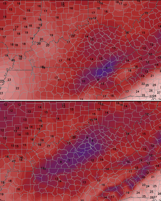
Current temperatures

Even colder air moves in for later tonight into Thursday behind a weak system diving in. There appears to be just enough low level moisture for a few snow flurries to fly across central and eastern Kentucky. Highs Thursday and Friday will only reach the low and middle 30s. Lows by Friday morning will threaten to drop to 20 or a touch below in some areas.
Throw in some wind and you get some very cold wind chills to start Friday and Saturday mornings…

That’s. Just. Cold.
Clouds will increase on Saturday as we watch a couple of systems stream our way from the southwest. It’s looking like the first system arrives Saturday night into early Sunday with a decreasing band of light snow. The High Resolution GFS shows this well…

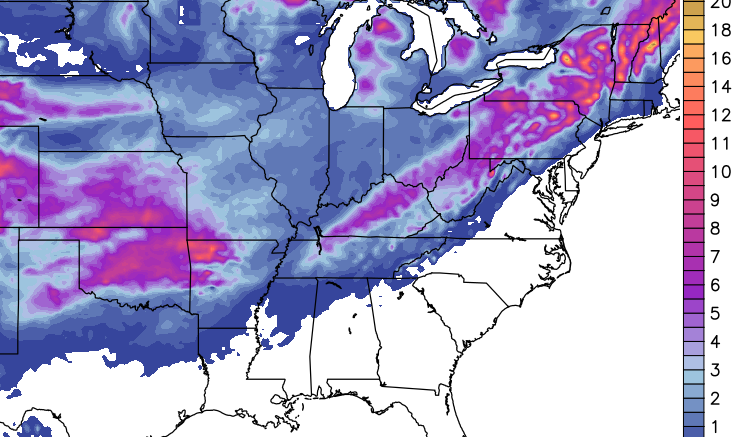
The trend in the models has been to shear that first system out and bundle more energy into a second system that develops later Sunday into Monday. The models have been hinting at this for the past several days and both versions of the GFS went in that direction overnight. The high res version shows a potent storm system impacting the region…
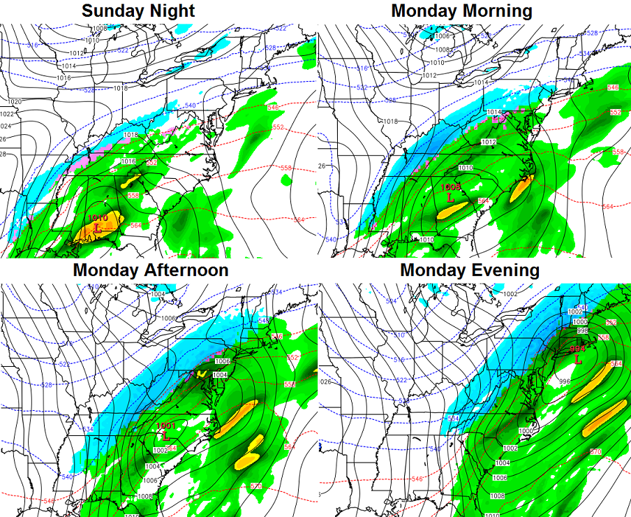
The snowfall forecast from that run was equally impressive…
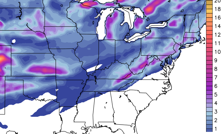
The older version of the GFS wasn’t as strong with this system, but was still buying into the accumulating snow idea…
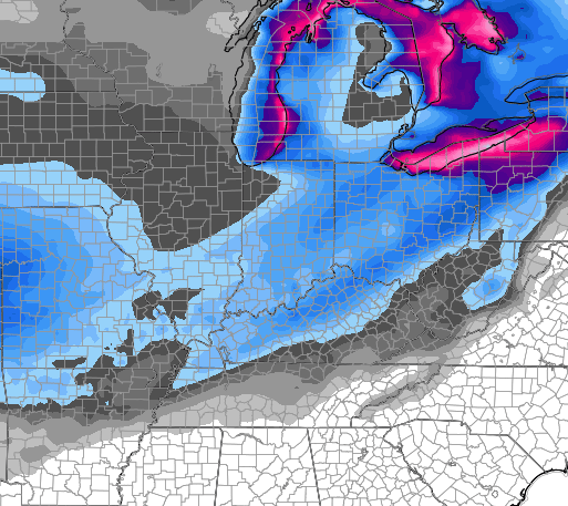
The latest European Model is showing a very healthy storm that tracks a little farther west and would imply some mixing issues. Still, it shows a nice swath of snow…
I haven’t shown much from the European this week because the pattern was playing into its weakness on handling energy coming from the southwest. It tends to hold onto that energy longer than it should.
Again, those are snapshots of one particular model run, so we shouldn’t get too caught up in what they’re showing. Instead, let’s look for trends with the models today and Thursday. If things are still looking this way over the next 24 hours, then we will ramp it up a notch on the threat potential. As of now, it’s in the very interesting category.
Whatever comes of that system, the models are forecasting another surge of arctic air to follow early next week. The GFS runs (old on top, new on bottom) have some super cold temps by Tuesday morning…
Busy enough for ya here in the middle of November?
Updates will come your way later today. Have a good one and take care.

Lookin’ good, CB! Thank you for all you do keeping us up to speed…
Thanks Chris. Can not wait to see if this pans out. If it’s going to be that cold,then it might as well snow.
http://youtu.be/FpE_STh3E8I
^My thoughts on winter. 🙂
^^Hilarious. I’m with Jeff. Let’s do this!
Early morning 06z runs of both GFS models did not look to hot..Looked to me like moisture moved more east..Hopefully the Euro show’s more potent system..Let’s see what 12z says..
Each model run will flip flop, by late tomorrow the models should have a better grasp hopefully come into somwhat of a better consensus. Either way doesn’t look like a real big deal snow wise just our first real snowfall of the season.
Better looking run on the older GFS…2nd piece of energy kicked into a higher gear..lol…Decent hit for part’s of Eastern Ky but temps may be an issue..
Thanks Chris. I agree with Jeff, too. Gonna be cold sitting outside at the game Saturday, but cheering on the Blue Raiders will keep me warm!