Good Wednesday, everyone. Our weather pattern continues to run in super-duper active mode and that means busy times ahead. More rain is on the way and that rain will become very heavy into the start of the weekend. While we track that, we also have to watch the increasing possibility of Old Man Winter fighting back early next week.
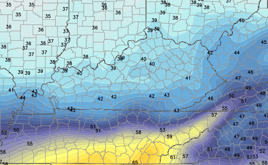
It’s not like we aren’t getting typical early winter weather out there right now. Things continue to run on the chilly side today and temps may even drop several degrees this afternoon as colder and drier air moves in. The southeast starts in the 50s and ends with upper 30s to low 40s showing up with showers moving away.
Current temperatures

Thursday continues to look colder with many areas struggling to get into the low 40s for highs. The GFS shows a few upper 30s…
 Rain moves in from southwest to northeast during the day and there’s a small possibility to see northern Kentucky start out as a brief mix…

That’s the first round of rain that really kicks into high gear for Friday and Saturday. Heavy rainfall will be a good bet with many areas coming in with 1″-3″ of water.
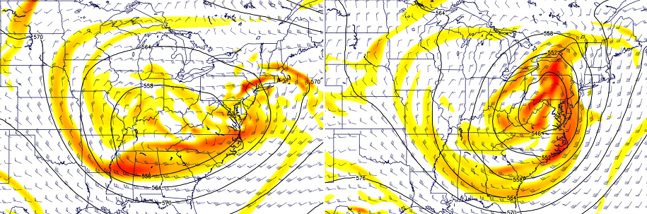
I continue to monitor the potential for winter weather into the first half of next week. The Canadian Model continues to show the wildest scenario of a huge cutoff low developing across our region then working northeast Tuesday into Wednesday…
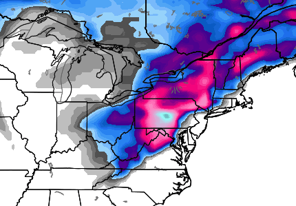
If that setup is real, it would produce a swath of snow from the Ohio Valley into the northeast…
The European Model has now joined in the cutoff low party…
You are going to see some very wild model solutions over the next several days. Some will likely show a monster storm, some may not show much at all. If the models are correct in depicting that strong of a system upstairs… a big storm will develop from that across the eastern half of the country.
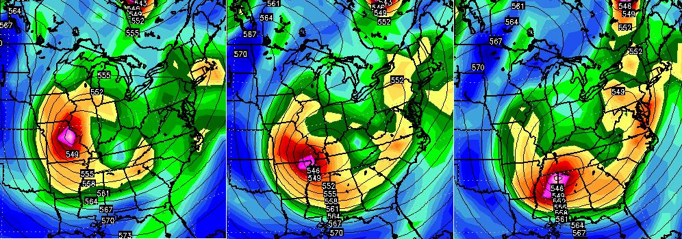
The Hi-Res GFS has been trending in that direction, but pops the surface low well off the east coast…
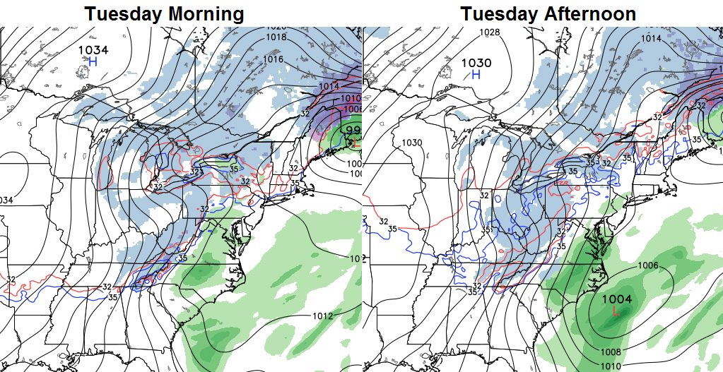
The bias of the GFS and it’s new version is to be too progressive with systems like this. Again… that’s if the setup turns out like the models are hinting at.
Chalk this up as “something interesting to watch”.
I will have updates later today. Make it a good one and take care.

Just wanted to say thank you for all your dedication to this site! I stop by many times each day and although I don’t comment I enjoy coming here for my weather!! You are #1!!
I wonder what the chances are for us to have a white Christmas?
50% Richmond and north. 0% Richmond ans south.
Thanks Chris. I’m excited about our snow chances this winter!
52 for low here in Carrie of knott co last night. Nice morning despite the drizzle
I love it when other meteorologist are calling for highs in the 50s, and Chris Bailey says 30s. We see who was correct today. Well Chris is the most accurate in central KY anyway. Keep up the good work.
all depends on where you live – KY is a big state; SE Ky has stayed in the 40s and 50s
Yea I was in bell co for work today and it was much warmer there. I was referring to the Lexington meteorologist that are on tv. The forecast they give are usually good for a 50-75 mile radius around Lexington. S.E. Ky is between Lexington and Knoxville forecast.
Thanks Chris. Today, I am thankful for the fact that although it is cloudy, it is NOT raining…..so far! 😉 Maybe, just maybe we can get that last outside wreath hung and plugged in! Looks like an interesting time coming up for sure. Can’t wait to see how it all plays out. ( OF course you know that we here in the tropics of southern KY will get a cold rain, no matter what else happens.) 😀 Have a great Wednesday, everyone.