Good afternoon, weather weenies. A cold rain continues to fall across the bluegrass state. A lot of this actually started out in frozen form with some sleet and freezing rain. That threat was pretty well telegraphed a few days ago, with the “new” GFS handling it well.
The rain continues this afternoon with temps in the 30s for many. Readings will rise toward 50 tonight and may push 60 into Friday as low pressure works across the region. Heavy rain and thunder will increase and carry us into Saturday. The models continue to spit out a 1″-3″ rainfall…
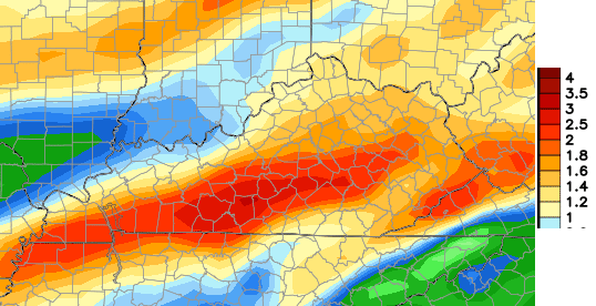
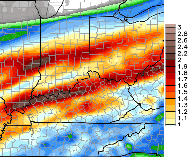
The differ a bit with the axis of heaviest rainfall, but the overall theme is the same. Winds Friday night and Saturday may gust to 35mph at times as colder air pushes in from the west. That will send temps tumbling from Saturday morning to early Saturday evening…
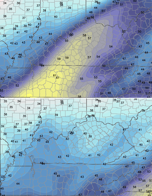
Temps by Sunday morning will drop into the upper 20s and hit the upper 30s to low 40s for highs.
I’m still playing the waiting game on what to do with the system for Tuesday and Wednesday. But, the model waffles could use a little more syrup. 🙂
I’m also trying to get you guys ready for a mild spell coming late next week into part of the following week. You’re a mean one, Mr. Grinch!
Another update comes your way later today. Take care.

Chris I really want some snow but guess we just get a warm up I really wish ky was a snow state we just got to get used to it I guess rain no snow oh will just glad to be alive
As soon as I start talking about seeing a mild spell late next week… the European and Canadian Models take it away. Anyone else seeing a trend here?
What’s the chances of Eastern Ky/ Sw VA getting in on a little snow next week?
Chris Mother Nature seems to be not agreeing with the models, so lets bring on the snow:)
Even if we do no get snow, the Rolo-coaster makes it almost worth it 🙂