Good Friday afternoon. Here’s hoping this update finds each of you having a good one on this damp and dreary day in the bluegrass state. I wanted to drop by for a quick update on where we go from here and to talk about the GFS finally seeing the light on the pattern for next week.
Let’s start with the weekend and roll ahead. We know we have the heavy rain to start and that takes us into early Saturday. As the way winds down, temps drop 20-25 degrees from early morning to late afternoon. Check out the numbers to end the day…
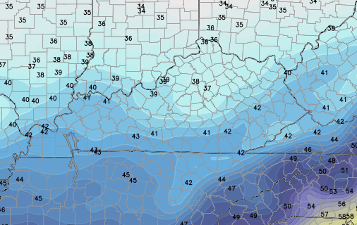
That sets us up for a much colder Sunday with lows reaching the upper 20s in many areas…
 Afternoon highs will range from the high 30s to low 40s.
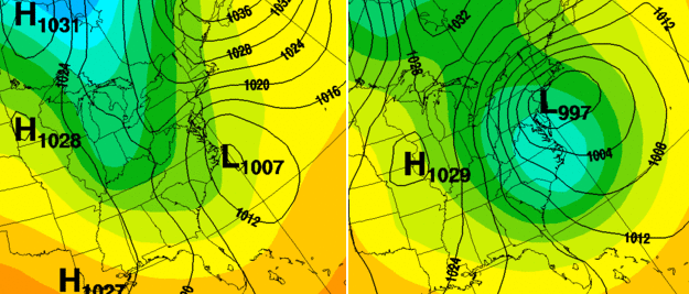
I still can’t tell you exactly how things unfold for the first half of next week, but I can tell you the GFS is FINALLY catching on. It still is lacking with the development of the big storm in the east, but it’s showing the digging jet stream and much colder air…
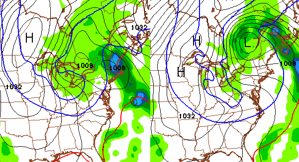
Those maps are from Tuesday and Wednesday. Snow flurries and snow showers could fly if that idea is right. Check out the lows for Wednesday and Thursday…
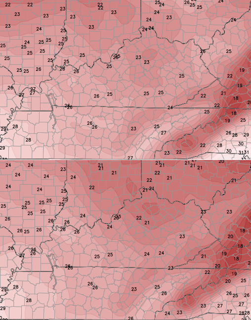
Highs from Tuesday through Thursday would be in the 30s. Those who blindly follow this model and just regurgitate what it shows are in for a rude awakening when they see the new run.
The NAM is trying to develop our east coast storm across the Carolinas, but the model doesn’t go out far enough to see what it does with it. The UKMET is doing something similar and would have a better chance of throwing some snow our way…
I will have another update later today. Take care.

U mean the model runs change, what???
U do great job of reading them and knowing when to trust them, when not to and honest like this time to say not really sure. Of course your like the rest of us and want the models then real life weather to bring us SNOW
Thanks for the great explanations and model comparisons. Am I correct that major blocking will show back up again for late December into January, meaning a higher chance of at least a “cold enough to snow” Christmas?
Bubbas 33/32 rule slways comes into play. The tile has wom more battles then its lost.
Other trend is models to trend nw unless ky gets in on snow action, then trend east.
Winter 09/10 and 10/11 surprised me, so we may get snow come January. still hoping for chris’ extreme winter prediction. He was right last year. was coldest since 90s
CFSV2 model is predicting a January much colder (5ºC colder) than normal around here so that’s why I wonder if Mr. Bailey’s thoughts line up with it.
My winter forecast was for a very cold January. 😉