Good Saturday, everybody. Rain, rain, go away is the weather chant of the day… and it just may work. Colder winds will blow across the state today and this will kick the heavy rain on out of town. Our day will feature tumbling thermometers as the temps skew colder than normal in the coming days. I’m also tracking a shot of possible winter weather for Tuesday.
Today starts with temps in the 50s, but those numbers will fall through the 40s during the afternoon. Upper 30s will show up by early evening as the last of the rain scoots across eastern Kentucky. There is the chance of a touch of frozen precipitation across the mountains in the southeast before it’s all said and done.
Temps by Sunday morning will drop into the upper 20s and low 30s. High temps will be downright chilly with a lot of upper 30s and low 40s. The NAM says we’re even colder than that for highs…
Monday starts with upper 20s and low 30s with afternoon highs well into the 40s. Winds will gust up as our system arrives from the northwest. That will usher in much colder air Monday night into Tuesday with a big storm blowing up along the east coast. The exact details on how this evolves are still to be worked out, but it does look like we have the potential for some light snow.
The European Model shows a potent upper level system diving right on top of us and forming a big closed low to our east…
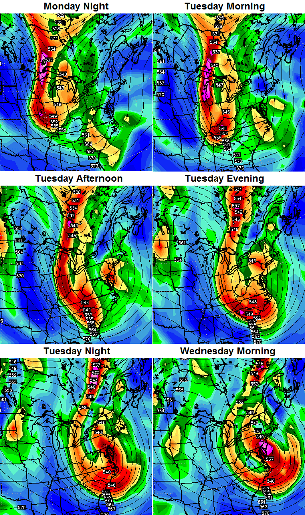
If it plays out like that, light snow would be possible as it passes over our heads and wraparound snow showers and flurries would be possible into Tuesday and Wednesday. The greatest chances would be in the central and east.
The GFS continues to progress toward what the rest of the modeling world has been saying for days now…
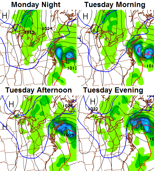
That shows a period of light snow Monday night and Tuesday morning with snow showers and flurries into Tuesday night across central and eastern Ky. Again… the exact details on how this all plays out will show themselves later in the weekend.
Normal to below normal temps will then hang tough through the end of the week with the possibility of another system dropping in from the northwest.
The pattern continues to progress toward one that likely turns very wintry in the week leading up to Christmas. Last night I showed some individual days from the super long range European model. These are from the same run, but show how the upper levels look on a weekly basis. Note the big ridge going up out west and into Alaska…


That sets up perfectly for some winter fun and games during the holidays. We’ve had snow on Halloween and Thanksgiving… might as well add Christmas and New Year’s to the list. 😉
I will have updates later today. Until then, track the rain and colder air…

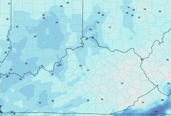
Current temperatures

Take care.

I don’t care how much or not it snows this winter. Life is GREAT! 😀
I expect bubbas 33 degree rule for monday night tuescevent.
33 grees and warmer : plenty mosture, with rain
32 degrees – no to very little mosture to work with , mainly flurries as system goes away. With temps well into the 40s monday afternoon, thats how i see it.
things may get interesting in few weeks.
Which year was we under tonado watch halloween, and thanksgiving both? Wanna say christmsas and new year had tornado watches also but I am probley wrong. 2004 or 2005 maybe?
33/32 is science! 🙂 😉 🙂
Well, it is real historic results for south of I64 at any rate. Trend busters are rare and not seeing it happen this winter, except a few ankle biters perhaps. Ice though has no problem busting the 33/32 law.
Cool update , Chris. Thanks for all the info and your expertise.
I’m with you Jeff Hamlin. I’d like some good snows this winter but I’m happy either way.
Big shout out to the Cats and the BBN that got loud and proud last night at Rupp!
Thanks Chris. I’m with Jeff Hamlin. Would love to see snow but either way life is good and I will enjoy every day! Have a great Saturday everyone!
We always appreciate your great attitude, Coffeelady!
Hope you get a good snow this season.
Hint’s of better thing’s to come are starting to show up on modeling…Higher height’s building at the pole,western canada,,,Goa trough is going going gone,,,,Shouldn’t be too long before we have a real snow threat to track…Christmas maybe?????
My winter forecast? Rain and 35 degrees or clear and 28……rumors of flurries…..next week’s blizzard always a week later lol.
We need hats with 33/32 on them.
Chris has the BEST forecast info and I really appreciate all the work he does keeping us up to date. My granddaughter is going to New York next weekend so I’m thinking she had better dress WARM. Thanks, Chris!
Please get us some snow down in Somerset early this week. We keep getting left out!!!!!!
This looks like something cool to play around with…new precip and temperature archive that combines airport, mesonet sites and more:
http://www.crh.noaa.gov/news/display_cmsstory.php?wfo=lmk&storyid=105601&source=0
My apologies is somebody has already posted this…I very rarely check this site during the winter months…
How old is that airport data? It was a tad warm for a long time until replaced recently. Nudge nudge 😉