Good afternoon, gang. A strange object is filling the sky across much of the bluegrass state. Yes, the sun is shining for many of us and it’s certainly a mood booster. If you’re a fan of winter weather, what’s coming Tuesday and Wednesday will also be a mood booster. Some festive flakes are on the way.
I have zero changes to how I think things play out in the coming days. A cold front swings through here Monday night and early Tuesday and is being pushed by a strong upper level disturbance. This will spawn rain and snow early on with snow showers and flurries becoming widespread as the colder air works in.
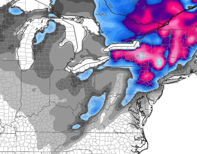
The GFS shows what I’m talking about…

You can actually see the connection to moisture coming off Lake Michigan. Notice how the snow shield increases as it moves from Indiana into Kentucky? That’s because of the change in elevation. The air is forced to rise and that creates more snow showers and flurries. NEVER underestimate the power of a northwesterly wind flow around here!
Can we get some accumulations? I suspect the answer is probably yes, but it might be one of those setups where it snows and sticks, then melts… then snows and sticks… then melts… you get the idea. That said… slick spots may develop Tuesday night and Wednesday night across the east.
The GFS continues to point toward some light stuff sticking at times…
The mountains in the southeast will have the best chance of picking up a few inches.
As I said, this isn’t a big deal in terms of actual snowfall. But, we’re likely to see flakes flying for 48 straight hours for parts of the region. With 2 weeks to go before Christmas, that’s a nice period of festive flakes!
Looking farther down the road… the small window of mild I’ve been talking about is looking even smaller. There may be another massive cutoff low developing next week. That one may be right on top of us instead of to our northeast. Just some food for thought.
Updates coming your way later today. Take care.

I’m not a fan of winter weather at all.I like to be out and active instead of being cooped up in the house all the time.
There’s a strange orange orb floating in a some blue stuff in the sky above my house. I don’t know what that’s all about, but I think I ought to call someone – just in case.
Roger getting bored with this weather. Chris, please get us a HIGH to the north and a developing LOW to our southwest. Sooner the better. Roger in Dodger!
Festive flakes is better than cold rain or cold and no flakes. If I recall a few or more years ago the set up was a complete opposite of the current. The cold air was suppose to drop in for next week and it kept getting pushed back by warming trends each week. Now everyone keeps talking of a warm up that just doesn’t seem to want to happen. Cold air keeps winning out. This pattern has been on going since last fall.