Good Sunday evening, gang. The pattern ahead of us is a very impressive one that is cutoff crazy. Slow-moving upper level lows will take center stage over the next few weeks and this is ushering in a very wintry pattern for the second half of the month into January.
The first cutoff gets going on Tuesday…

That’s the system that gives us a nice flow for snow showers Tuesday into Wednesday. The upper level low then lifts to the northeast, but starts to turn back toward the west and south by late week…
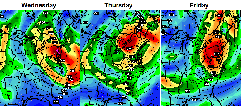 Think of that system spinning like a bicycle wheel that has spokes spinning with it. If the wheel gets close enough, a few of those spokes could brush Kentucky. If that happens, flakes may fly across the east into the end of the week.
Regardless… that’s a seasonable cold pattern across our region.
The models are then trying to develop another cutoff into the first half of next week. The European Model is probably giving too much separation between a system across our region and one well to our south…

Those two could try to get together for a much bigger system slowly spinning across our part of the world.
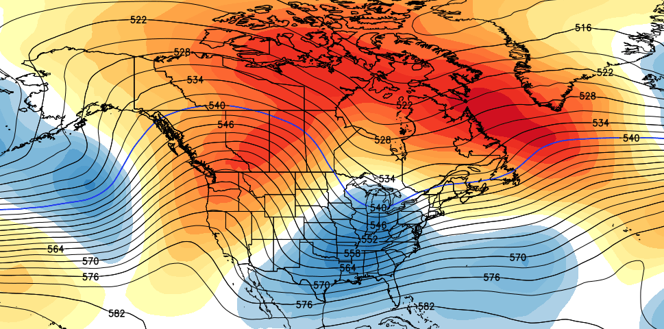
All of this leads us into a pattern that has a ton of winter written all over it from Christmas week through January. The GFS Ensembles start Christmas week with a big ridge out west and a developing deep trough across the east…
Ho Ho Ho!
Enjoy the evening and take care.

Thanks for your time and the updates. The weather channel can’t make up its mind. First there’s snow, then it disappears.???
I would love a white Christmas! Thanks Chris for all you do!
Awesome!
Don’t tease us!
I’d love a white Christmas (and Christmas week)!!!
Big build up and then we will get nothing. That’s the winter weather pattern that is most likely.
The only thing he’s “building up” is a winter-type pattern. He isn’t saying large amounts of accumulating snow or anything like that, so I don’t think he’s trying to get our hopes up.
Bring on the cold temperatures! Thanks for keeping us informed, Chris.