Good Monday to one and all. We have a cold front knocking on our door and it will be pushing it’s way on into the region later tonight. That will usher in colder air and rounds of snow showers and flurries that will carry us into the middle of the week. This isn’t a big deal, but some flakes flying 2 weeks before Christmas will certainly get folks in the holiday spirit.
Your headlines:
– Today is a fairly nice day ahead of the front. Winds will gust up as temps spike into the upper 40s and low 50s.
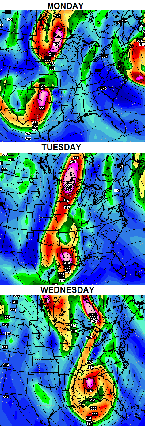
– The cold front arrives late tonight and Tuesday morning with a band of light rain ahead of it and snow showers behind it. Temps will drop from northwest to southeast through tomorrow morning.
– A northwesterly wind flow will combine with the passage of a strong upper level disturbance to create snow showers and flurries with temps in the 30s Tuesday.
– Snow showers and flurries should hang tough into Wednesday across the eastern part of the state.
– Many areas will, at least, pick up on some flakes Tuesday and Wednesday. Here’s a look your odds of seeing some of the action…
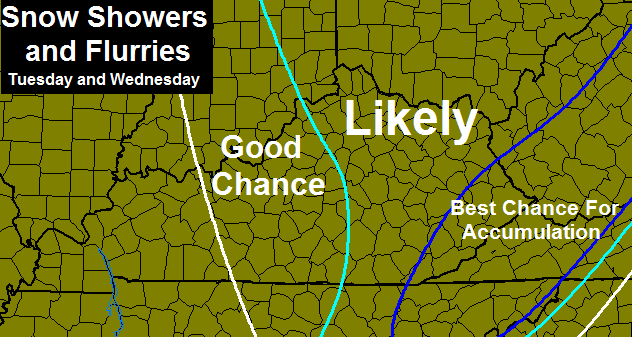
– As I’ve said for a few days, most of what falls won’t be sticking. The best chance for some sticking snows would be Tuesday night and Wednesday morning… especially across the mountains in the southeast.
– Temps stay normal to below normal through Friday as we watch to see what the big closed low in the east does. The European Model keeps it close enough to possibly throw a few more flakes to the east.
– I still think we can squeeze out milder days this coming weekend before another system rolls in early next week.
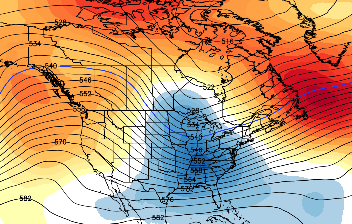
– This one bears watching as it could come via another big cutoff area of low pressure. The European Model is still showing two big systems that are trying to get together to form a huge storm. Here’s what that looks like upstairs…
– All of this leads us into a pattern that features a significant change toward winter weather across much of the country. The long range ensemble runs continue to advertise a deep trough developing across our region Christmas week…
– That pattern is going to try to go extreme on us as we head into January. The recent run of slow moving storm systems may be sign of what’s to come. This time… there will be much more cold air available! 😉
I will have updates later today. Take care.

You know what goes great with long overdue snow sightings? Grilling some burgers out on the deck as it comes down!
http://www.cheeseandburger.com/
Cigars and good beer work too! 😉
Thanks CB! 🙂
What is the difference between “likely” and “good chance?” Thanks.