Good Monday afternoon. Things continue to progress toward the ideas we’ve been talking about since last week. A strong upper level disturbance swings in here tonight and Tuesday as colder air pushes in. This means snow showers and flurries will be flying for many over the next few days.
The actual cold front is just a smidge slower and may not move through here until the first part of Tuesday. That would mean rain showers and a mix of rain and snow showers would linger a little longer with snow showers and flurries taking over the deeper we get into the day.
A northwesterly wind flow will keep the flakes flying into Wednesday with the best chance across central and eastern Kentucky.
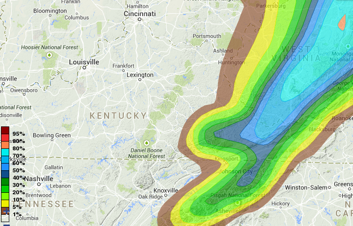
This isn’t a big deal in terms of snow with a lot of the festive flakes melting. If we are to get some accumulation, it would be across the mountains of southeastern Kentucky. The WPC has given this area the best chance at picking up 2″ of snow through Thursday…
I have no changes to where we go from here and I will touch more on that with the evening update.
Until then, track the weather we have out there now…

Current temperatures

Take care.

i love a quickie
Thanks Chris.
Tough to be a Bengals FAN!!
IMO, tough to be a snow lover fan here in CKY! Why couldn’t I live in New England, winner for football and snow!!
Did you see the email a reader sent in to Grantland about Dalton? Marvelous stuff.
http://grantland.com/the-triangle/the-week-14-mailbag/
until the Bengals r sold they WILL NEVER be any good. the BROWNS r a joke as owner MIKE is.
The local met’s in WV are all predicting 60 or higher all next week. Hopefully the warm wave will be gone by Christmas week.