Good evening, gang. We’re putting the wraps on a nice looking day across the commonwealth. One of the products of a clear sky will be a cold night across the bluegrass state. Readings will drop into the low and mid 20s for many areas.
It looks like more sun will be around on Friday with temps reaching the 40-45 degree range. Soak that sun up because more clouds are coming back in for the weekend. Those clouds will keep temps in the 40s for many and could even throw some sprinkles or light showers at us.
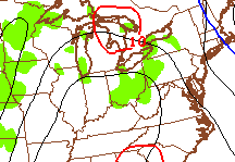
The best chance of that might come Sunday. The models are picking up on it…
The next storm system moves in late Monday into Tuesday. That brings rain our way and will be followed by much colder air by Tuesday night and Wednesday…

That could even bring some flakes to parts of the region if things work out.
The models continue to point toward a much bigger storm trying to develop later next week into the following weekend. As expected, they are changing from run to run, but the European Model has a nice look for winter lovers..

 We will have to wait and see how that system works out. I am personally hoping it brings rain to Kentucky because I will be in Chicago that weekend. If it rains here it would likely bring snow there. Don’t judge me. 🙂
Enjoy the evening and take care.

I will be here for that system but I will be leaving the Tuesday that follows that storm (if any) to Texas. 0% chance of snow to the part of Texas I’m heading to (Brownsville, TX) Though there will be beautiful weather over there. The 7 day forecast calls for highs ranging from low 70s to low 80s with lows in 60s and chances for thunderstorms! I wouldn’t mind that!
I am ready for snow but I will be traveling on the 20th so I don’t want it to be to bad on the roads!
I see how you are CB….
now Bailey, u pull the warm air with u, be rain everywhere.lol
That’s messed up CB wants a lake cutter. lol
May your chance of snow success match that of a Cubs World Series win. 😉
Cubs just signed Jon Lester to a 6 year deal. That’s a start in the right direction.
Back to the future.. oct 21 2915
“Wish I went back beginning of season snd put some money on the cubbies” cubs win world series over miami lol
Wish I was in texas to see my girls but nope, not right now I cant go. Maybe spring break.
Remember to think snow! The 540 line in bottom pic looks far enough douth to bring snows to ky. Snowfall pic shows best chance hazard eastward and maybe upper jackson co northwards
But maps and models will change a lot between now and event time. The feb 2012 sunday snowfall surprized me, I honestly didnt think daytime snowstorm could stivk but I was wrong. 5 inches . Usually snow has hard time sticking in daylight hours during feburary due to dun angle. Just my thinking .