Good Wednesday and Happy New Year! We have clear, calm and cold conditions across the bluegrass state as we close out 2014 and say hello to 2015. Two of those three will change in a hurry as active weather rolls back in. This time, the cold is around and will make for a lot of interesting weather.
In the short term, temps hit the upper 20s and low 30s for highs today with partly to mostly sunny skies. We’re in the high teens to low 20s as the clock strikes 2015.
After a calm first day of the new year, things get active in a hurry. Overrunning moisture streams into the region late Thursday night into Friday morning. That may touch off some light frozen precipitation for some…
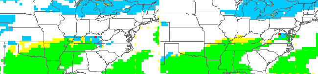
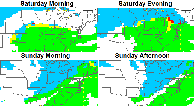
Light appears to be the operative word with this first batch that’s primarily early in the day. But, it only takes a small amount of freezing rain to cause some bigger issues. The afternoon may see improving skies as we await the main storm system late Friday night into Saturday. Temps Friday night and Saturday morning will be VERY close to freezing and that could spell a brief mix or some freezing rain before rain takes over.
Low pressure will then pass overtop of the region with a spike in temps ahead of it on Saturday. That spike is also brief with tumbling temps and the chance for light snow or snow showers on Sunday…
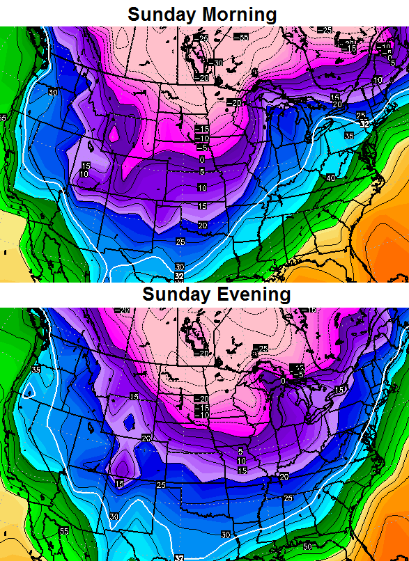
The GFS is trying to develop a decent band of light snow in the cold air Sunday afternoon and evening. Speaking of the cold air… check out this temp tumble from Sunday morning into the evening…
Throw in gusty winds and wind chill numbers will be much lower into Monday.
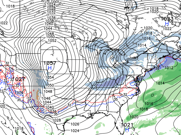
The pattern will then feature a system diving in here from the northwest and that’s one that may try to develop into something a little bigger. The GFS is certainly going that way…
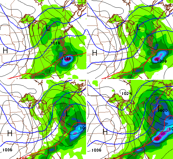
The NEW GFS shows a HUGE arctic high pushing that system…
The model numbers behind that front continue to be super duper cold. Check out the temp plunge from morning to night…
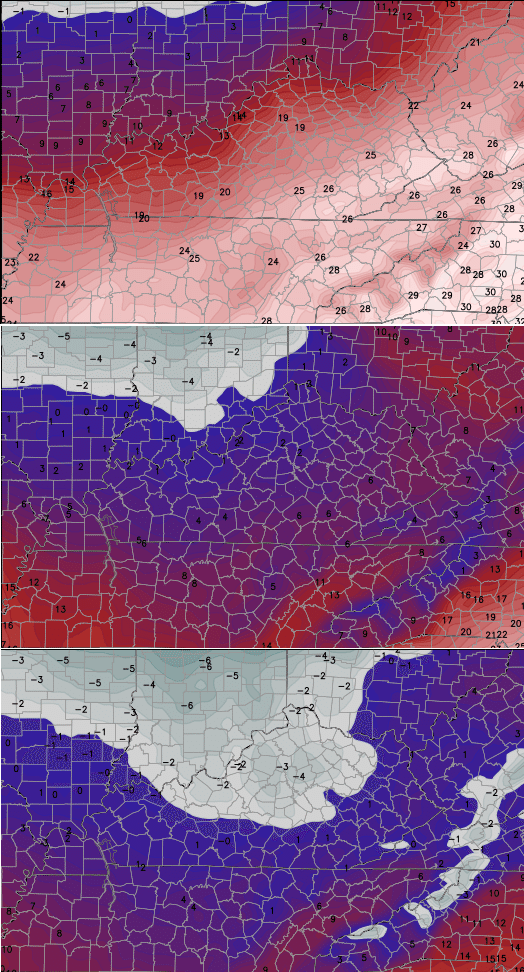
Again… I’m not sure we get THAT cold, but you get the idea of how vastly different this pattern is from where we’ve been in recent weeks.
I will have updates later today. Make it a great day and take care.

THANKS FOR THE UPDATE CHRIS I APRECIATE IT STAY SAFE MY FRIEND.
Thanks Chris. Yes it is cold out. I’m looking forward to adding some snow to the mix!
Have a great day y’all!
Just came in from scraping ice from my daughter’s car. I can confirm the cold.
Also — I am now confident enough to say my part of Richmond will have 0, no, nada, zip snow for the first half of winter. This is the first year I have seen none in the November, Decemeber timeframe, less a slight dusting on the neighbors roof once a month or so ago. Let’s hope for a strong second half!
We did get that roof trace 😉 Or was that frost….
looking forward to the spike in temps as the moisture arrives says absolutely no one
Happy new year everyone. Here’s to a great 2015 to all of you!
Ditto!
A balmy 6° in central Illinois.
No snow either…what a waste.
Hey! I think this will be one of the coldest if not the coldest new years in well over a decade. I remember new years being above freezing or unseasonably warm and rain as well. Not as far below freezing in a log time for the evening.
I agree! Also your clipper for next week looks to be missing us to the north. We have the NW shift on southern fed storms now is there a south east shift for clippers? Ha ha.
Thanks Bubba. That’s something to build on!
Hopefully next week’s clipper will start to dig more south in the coming days. If it doesn’t let’s be honest would it really shock anyone???
Death Valley gets snow, we will get RAIN. Lol!
Happy New Year everyone! Hoping for a overachieving January full of snow.
Impressed by the blog’s call on temps so far this fall/winter season….on the flip side, the precip predictions have fallen flat….better luck for winter 2015…
From the looks of this update, this winter basically remains a dud. I predict it probably stays that way, with a possible snow shower or two over the next couple of months.