Good Monday, everyone. The week ahead is going to look and feel a whole lot like May across the bluegrass state. Temperatures will be very warm, humidity levels really spike, and rounds of thunderstorms will blow through the region. The temps are great, but the storm threat is something we could do without.
A scattering of showers and storms push into the region today. This doesn’t look especially heavy, but some local downpours are possible. Temps will be held in check for areas getting in on the drops…


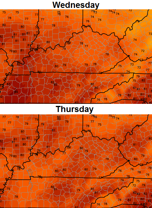
Temps will really take off for the rest of the week. Highs from the upper 70s to low 80s look good for, at least, a few days…
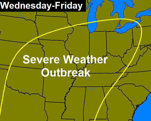
Rounds of showers and thunderstorms will be possible each and every day this week. That doesn’t mean you will get storms each day, but the potential is certainly there. We will have to watch for strong and severe storms ramping up during this time. The best threat appears to be during the second half of the week. That’s when a significant severe weather outbreak may occur from the plains into the Ohio Valley…
Heavy rainfall is a given with the storms and it’s a pattern that throws another big system our way early next week…
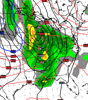
This is a very active weather pattern that continues to take shape. It’s one that should have plenty of severe weather and heavy rain through the rest of the month and into May. Before all is said and done, some cities may see this spring go down as one of the wettest on record.
Have a great day and take care.

I like gentle rains and just plain thunderstorms, and I do get excited with the severe storms, but I don’t like seeing people get hurt or property damaged. I just like exciting weather. thanks Chris for keeping us aware of it all.
Ditto
Exactly.
Please tell me this is not a tornado outbreak !!!!
Probably will be to our west. Missouri,Illinois,and Iowa.
But not here ? I am already worried
All depends on the timing of the front.
Thanks Chris. Would prefer some sunshine with the warm temps but doesn’t look like that’s going to be the norm. Anyway it’s Monday…. Have a great day all!
Thanks Chris. Would prefer some sunshine with the warm temps but doesn’t look like that’s going to be the norm. Anyway it’s Monday…. Have a great day all!
Haven’t seen that term ‘humidity’ thrown around in a long time. For now, it is welcome. Ask me again in July, though.
I wonder if we will really see all that much severe weather in Kentucky this week or if we’ll just see way too much rain.
Sounds like great weather to get the garden off and growing fast. Good luck dodging those severe storms everyone!
unless your garden is still under a foot of water. 🙁