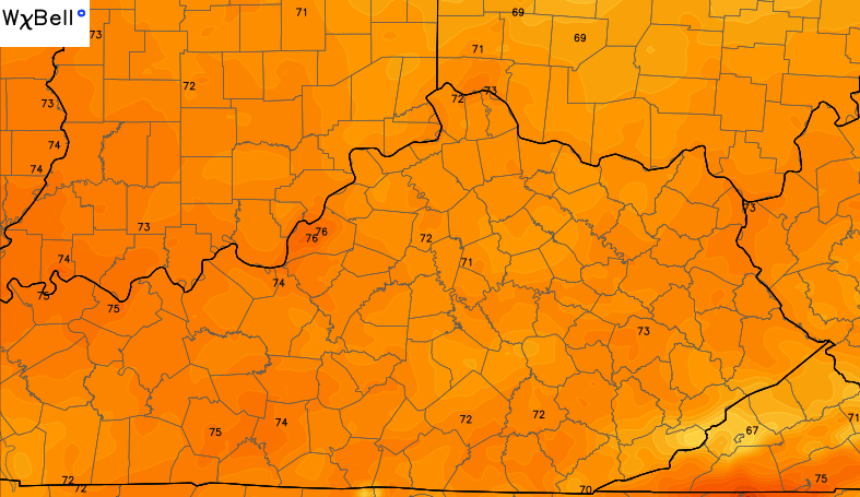
Good Monday and welcome to June. Today is the start of meteorological summer, but someone forgot to give Mother Nature the memo. Much cooler than normal temperatures are out there today and the cool is being accompanied by some damp weather.
High temps today may not get out of the 60s for parts of our region. There’s even the chance for a few spots to struggle to get into the low 60s. Showers and thunderstorms will work across the region during this time. Some very heavy rainfall may be noted at times. More in the way of out and out thunderstorm action may show up across the southeastern corner of the state.


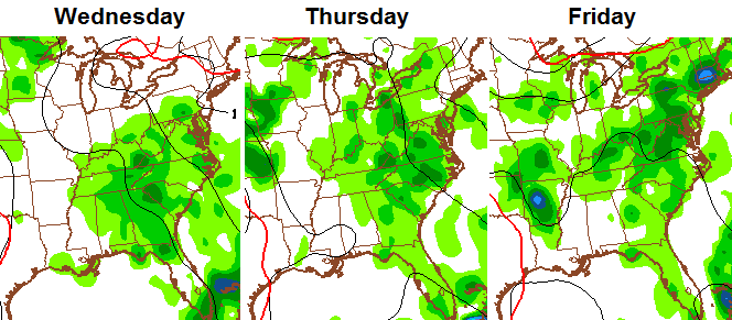
The threat for scattered showers and storms will linger across the east and southeast into Tuesday. A mix of sun and clouds will be noted across the rest of the state with pleasant temps…
An upper level low then sets up across the Tennessee Valley into the deep south by Wednesday…
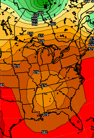
The counterclockwise flow around that pulls up some moisture from the south and southeast. That results in an increase in scattered showers and storms…
Temps will increase during this period, as well. Another upper level low tries to cut off around here next weekend…
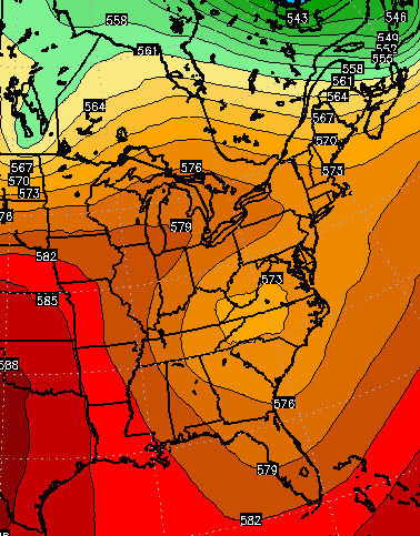
That would keep the threat for scattered showers and thunderstorms going.
A deeper dip in the jet stream shows up a few days later…
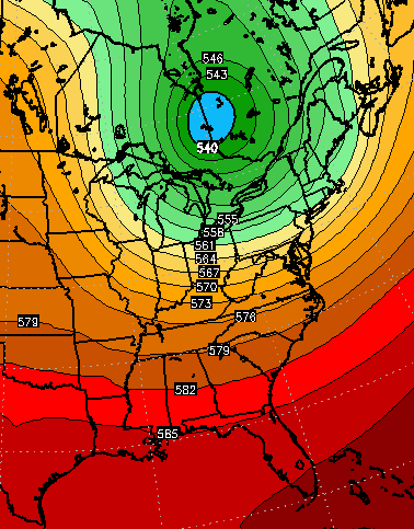
That’s the shot of cool air the CFS has been forecasting to dig into the region for the middle of June.
Have a great Monday and take care.

Thanks Chris. Not the best forecast but it could be a lot worse. And besides, it’s Monday, and rainy days and Monday’s always get me down. (sorry, couldn’t resist). Have a great Monday everyone.
The weather is fairly ugly, and more so for a Monday morning, but after last night’s Game of Thrones, I’m still too wired for it to matter.
No spoilers! I have not watched it yet 🙂
June 1st, 8:06 am. 57 degrees and pouring rain. Crazy!
Correction: 53 degrees
1:36 pm. 53 degrees and still pouring rain. And still crazy!
Had a nice storm here in Pikeville. I call it nice because we didn’t lose power.
Rained mostvof afternoon in manchester todat, from around 12:45/1:00 till close to 4:00 i guess. Rain is good on my garden, what little stuff i have out. Things was getting dry.
Shades of June 2003.