Good Wednesday, folks. Summer continues to be AWOL across our part of the world with much cooler than normal temps. We are going to warm it up in the coming days, but true summer heat doesn’t look to make a run at us anytime soon.
Let’s start with today and roll forward.
Moisture will increase from southeast to northwest. That means scattered showers and storms will go up across central and eastern Kentucky. Southeastern parts of the state could get in on some decent boomers that put down enough rain to cause some local high water issues. Highs today (I think) hit the upper 60s and low 70s.


Temps try to warm toward 80 or better from Thursday into the coming weekend. High temps will depend on the amount of clouds and storm action on any given day.
The threat for scattered storms increase later Friday into the weekend as another dip in the jet stream moves in from the northwest. It’s a pattern that can deliver some healthy thunderstorm clusters into early next week. Watch how this beats the heat down…
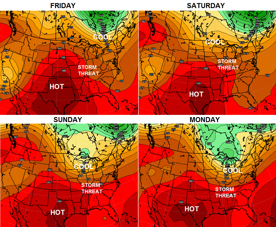
I have a feeling we’re going to be seeing a lot of that this summer. Of course, that doesn’t mean we won’t be seeing some hot days! 😉
Recently, I wrote about the developing intense El Nino and the potential implications later this fall and winter. I’m fascinated by the placement and strength of the El Nino from the seasonal forecast models, because there really aren’t any good analogs for it.
I posted the winter forecast from the JAMSTEC last week and am looking at some of the other seasonal models to see what they think will happen. Here’s the latest CFS for December-February…
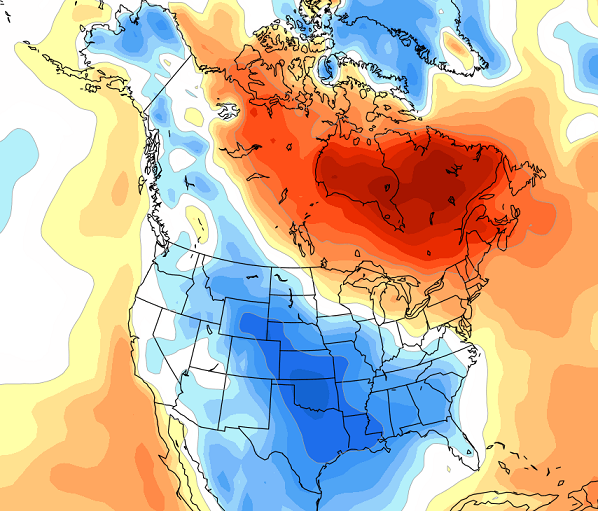
Obviously that has a lot of blocking across eastern Canada and leads to another cold winter for much of the country.
Throw in the month of March…
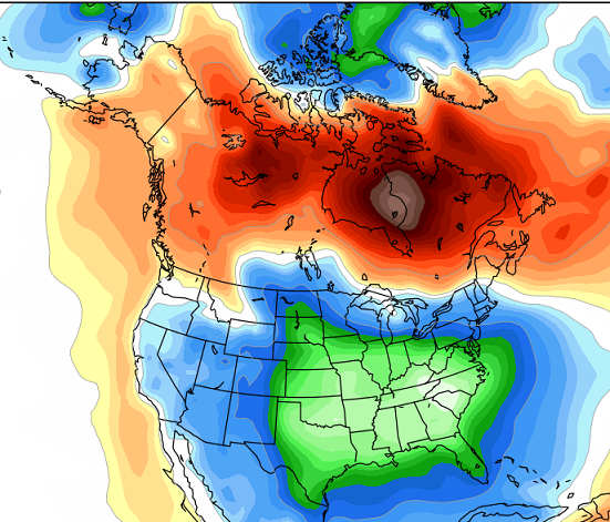 and you get a bit of a “wow” factor.
For a friendly reminder… it’s June and winter is a long way off, so don’t get married to those maps. 😉
Have a great day and take care.

It certainly makes for good weather to sit outside and have a nice cigar and beverage when it is not raining. 😉
Hamlin, but, but that’s not what the ‘pool’ kids wanna do these days.
Love the blog and the long range outlook….I like the weather and sure wish I would have studied Meteorology, but I can do it vicariously now thru KY Weather Center…
Those maps make a great case for polygamy.