Good Friday to one and all. We’ve made it through the week and we’re just about to kick off the first weekend of June. Warm temps and an increase in humidity levels will lead to the threat for scattered showers and storms through the next few days. That action looks to ramp up a bit as we head into next week.
A few rounds of showers and storms will try to push our way from the plains states later today into tonight. How far east can this action get is the question I’m wrestling with. The best threat to see some showers and storms should be across the central and west. Highs will hit the 80s.
The same issue is with us over the weekend. Scattered showers and storms will play around with our thermometers. Temps will hit the mid and upper 80s for areas getting in on a mostly sunny day, and stay several degrees cooler for those areas getting some clouds of storm action. I do not see any day being a washout by any means.
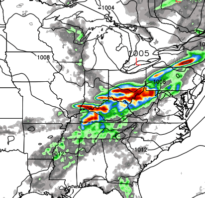
A cold front then moves in here later Monday and Tuesday with a better chance for showers and storms. Here’s the GFS…
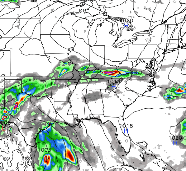
The European Model is similar…
That front is likely to put the brakes on and hang around here through much of next week. The European Model shows this setup with a tropical system down in the Gulf…
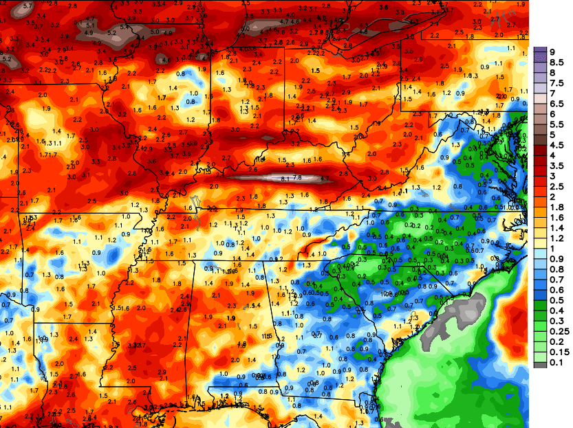
That would obviously keep the threat for some showers and storms around here. In retrospect, the European Model has faired MUCH better than the GFS with the overall setup and the rainfall numbers. This is the first time the European Model has shown some robust rainfall totals with the 10 day forecast…
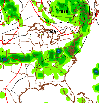
Speaking of storms and rain chances, let’s track what’s out there today…


Have a great Friday and take care.

Looking forward to the warm temps
Chris, my family is heading to Florida Friday. Praying there is nothing coming in the gulf that week ?
Wow, prayers for those in Texas! Thanks Chris
https://kyweathercenter.com/wp-content/uploads/2015/06/Euro-2.png
I do not like the positioning of that bullseye across the center of the state. I do not have a pool to fill…because if I had one, I’d have been using it since March. 🙂 Unless that’s metaphoric rain that’s going to wash out local govt. corruption in Berea, Do-Not-Want.
On an unrelated note, CB, save this one for the next time you make an against the grain prediction that later comes true.
http://i.imgur.com/UGTojTG.gifv