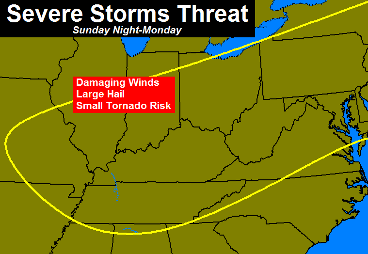
Good Saturday afternoon, gang. Your friendly weatherdude is dropping by to update the potential for severe storms late Sunday night into Monday. A strong cold front will bring a couple rounds of big boomers our way during this time and some of those could cause problems.
The air ahead of this front is really going to juice up. Highs Sunday should reach the mid and upper 80s with increasing dewpoints. Some areas could see their first 90 of the year.
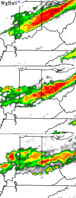
The first line of storms rolls in from the northwest Sunday night into Monday morning…
That line then diminishes as another round develops and sweeps eastward during the afternoon and evening hours. The simulated radar from the NAM…
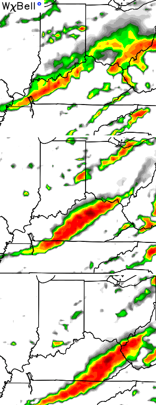
That continues to be an impressive signature coming from that model. Severe weather is possible from Sunday night through Monday across much of the region…
I will focus more on that potential with the normal late night update. Until then, enjoy the rest of your Saturday with the tracking tools…


Take care.

Good day to read this blog.
The SPC threw up an ‘Enhanced’ risk of severe weather up into Indiana for tomorrow and while I still don’t like their additional categories of severe weather that alone got my attention before this post.
Thanks for the update Chris. Keeping us informed ahead of things, as usual. Appreciate all you do.
kudos!!!
Ill be standing by
Glad to seem some NAM data in this post as the GFS model has been terrible for weeks now regarding all of the rainfall that was suppose to have hit the state plus the temp forecast last week! I think the NAM is fairly good at predicting severe weather!
Could a derecho be a possibility? I haven’t looked at the data lately so I’m not sure if conditions could be favorable for it or not.