Good Tuesday, everyone. Rounds of severe thunderstorms that blasted the bluegrass state on Monday are well to our east, but that doesn’t mean we can’t sneak out a scattered storm or two today. After today, steamy days are ready to set up shop around here and could be joined by more storms.
Highs will generally run in the low 80s for much of the state under a partly sunny sky. We have to keep an eye out for a storm or two trying to pop… especially across the south.

Temps begin to steam up on Wednesday with mid and upper 80s setting up shop. There will be a small thunderstorm threat in the north.
Thursday and Friday should feature a lot of upper 80s with a 90 here or there. Humidity levels will also increase as our flow comes from the southwest…
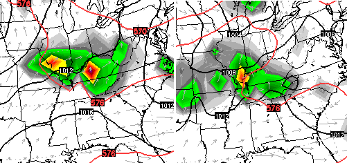
That’s a very warm and humid setup that should be able to fire off rounds of scattered showers and storms. The European Model…

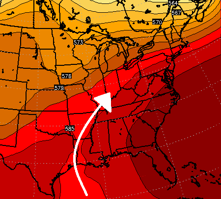
The same model then develops some pretty good heat across the south and southeast into early next week. Check out this heat ridge showing up…
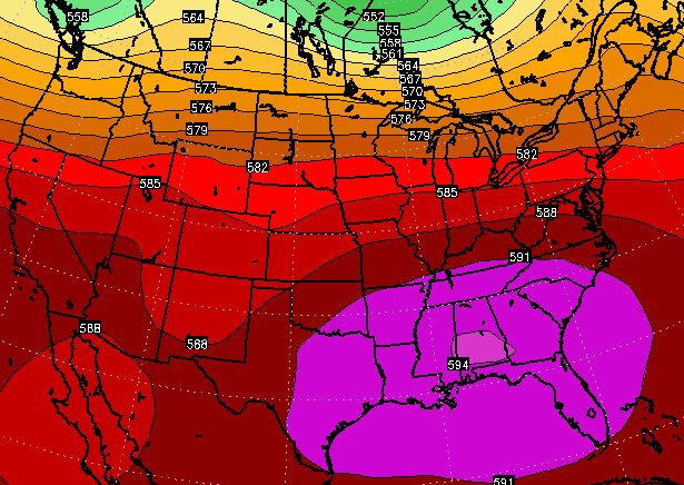
Upper 80s to low 90s will be likely on days featuring full sun. A situation like that could also have clusters of thunderstorms roaming about the northern edge of the heat, and that’s exactly what the Euro is showing…
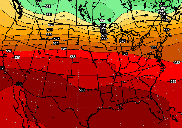
A few days later, that ridge is forecast to get smacked back down…
 As I said, some steam and some storms setting up later this week through next week.
Enjoy your day and take care.

Im reminded of Johnny Cash’s “Ring of Fire” with this setup.
Thankful for the “dome of protection” over SE Lexington yesterday as the weather was uneventful with little rain, hardly any strong winds or lightning and no hail. The worst set up shop to the north, southeast, and south of us.
I think a weak derecho hit around 1:30 last night in Paris. Our tallest tree fell and leaves are stripped off the tree.
That should be plural — leaves were stripped off trees.
It was very windy for five minutes or more but no rain.
No such thing as a “weak” derecho in my book. Derechoes (spelling?) are about as bad as tornado.
Whatever it was, it made a mess!!
Derechos are long lived widespread damaging thunderstorm complex that can last for many many hours and travel hundreds of miles, very destructive. What you might of experience was a isolated microburst from a thunderstorm.
Yea, don’t underestimate a microburst! Funny, my spellcheck says microburst is spelled wrong?
Is a microburst possible when there is no rain nearby? I pulled up the radar when the wind started and there was a storm cluster north of us, but at least 25 miles away.
Weather history tidbit. On this day in 1953 was a seemingly way out of place violent tornado – in M*a*s*s*a*c*h*u*s*e*t*t*s of all places.
Parts of the Great Lakes were hard hit the day before, including an F5 twister at Flint Michigan.
http://en.wikipedia.org/wiki/Flint%E2%80%93Worcester_tornado_outbreak_sequence
Thankful for the much needed rain in Harlan Co–nearly 2 inches widespread!
Measured 1.17 inches last night in my rain gauge. Similar to the 1.08 recorded at the Nashville International Airport.