Good Wednesday, everyone. We are finally catching a bit of a break in the super stormy action we’ve been seeing for the past several weeks. Rounds of torrential rain producing thunderstorms have devastated parts of our region, with lots of wind damage to go along. Mother nature certainly owes us!
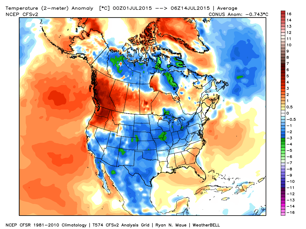
It’s hard to wrap our heads around just how wet things have been. Maybe some numbers will help us out. Here’s a look at the departure from normal over the past month…
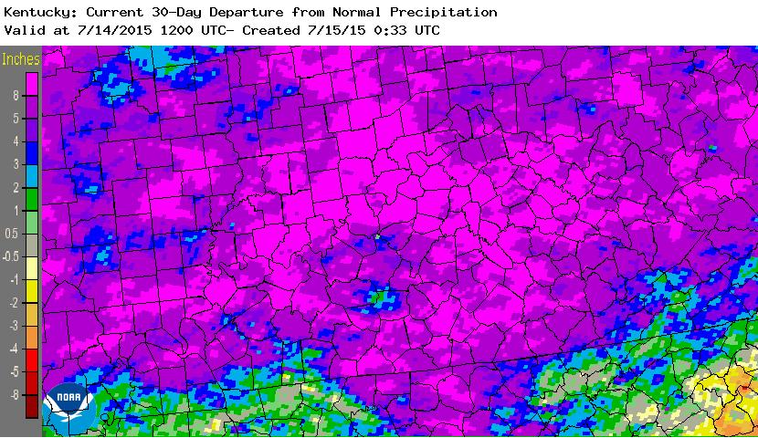
Most of the state is 4″-9″ above normal for the past 30 days. If we expand that to include the year to date, the numbers are staggering…
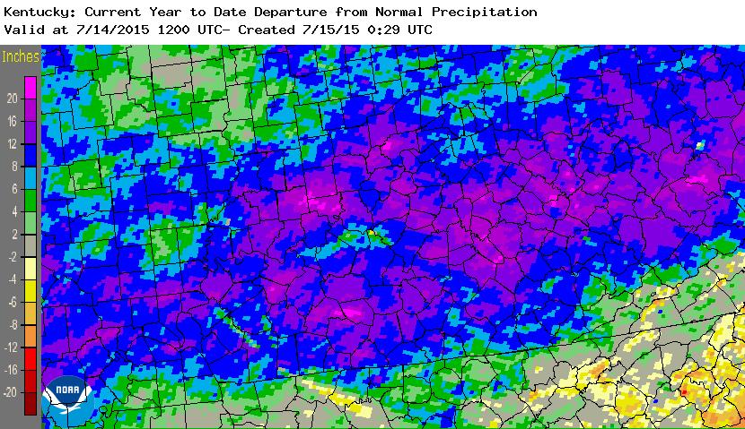
Many areas are more than a foot above normal with some pockets of 20″+ showing up. Absolutely amazing to see those kind of departures.
So, we need a BIG break, but we will take whatever we can get. The weather from today through Friday will feature a lot of dry times, but some isolated showers and storms will still be possible.
Temps will be fairly pleasant today and Thursday across central and eastern Kentucky with highs ranging from 80-85 in many areas. The west will be warmer, as usual.
Our numbers for the entire region will jump this weekend as the western half of the state goes back into the 90s. The waterlogged ground of central and eastern Kentucky will come into play at this point and keep our temps below what the models advertise. Lots of upper 80s should show up with a shot at a 90. The humidity will be the big player and will absolutely make things unbearable at times. Scattered showers and thunderstorms will be around and could wind up being bigger players than I currently think. Don’t bet against storms this summer!!
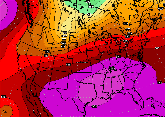
The steam of the weekend comes from as a heat ridge across the south flexes some muscle into our part of the world…
In typical fashion of this summer, that doesn’t stay around long and gets booted back to the southwest into early next week…
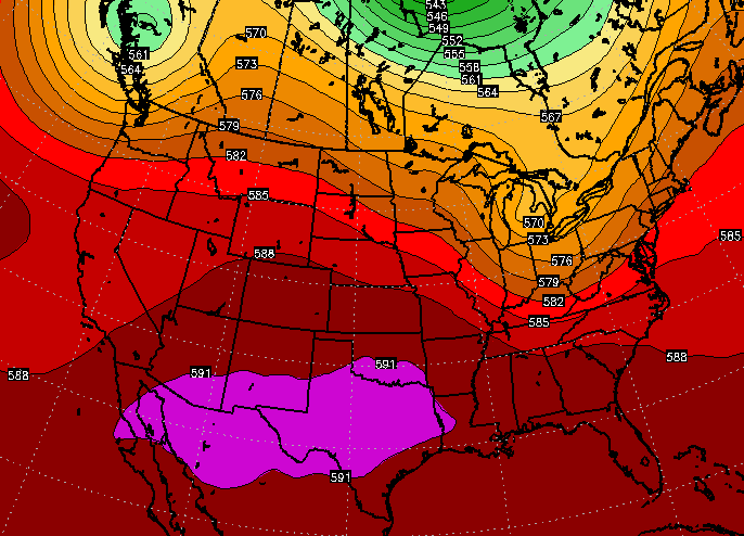
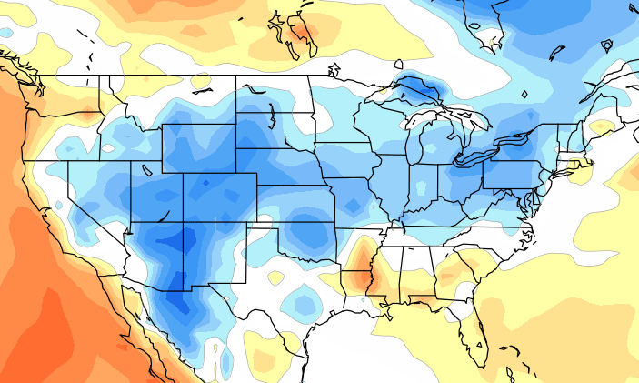
That should bring additional rounds of showers and thunderstorms our way as temps come back to normal or a touch below. The below normal part has been a common theme across much of the country for the first half of July…
If the CFS is right, temps may continue to average that way deep into August…
I leave you with a post stormageddon version of the tracking tools…


Have a great day and take care.

http://i.imgur.com/YfQsbnS.jpg
Got to catch up in Harlan Co! We should not be in the normal range for year-to-date rainfall. I guess that shows just how dry things actually where down here until the pattern change in June! I was a drought monger only because I was telling the truth, although I never thought Central KY should have been included in the drought monitor to start with! No mention of drought any more any time soon now!!!!
Thanks Chris. A break is certainly welcome news for everyone, especially those folks in Johnson Co and the other counties sonde estates by flash flooding. My heart goes out to themed my prayers. A big THANK YOU to you and your weather team too, for keeping us up to date and safe. I’m sure your teams work saved some lives, even as they are searching for a few missing yet.
Make it a great day everyone and if you can help someone today, just do it! Happy Wednesday.
Have I mentioned on here how much I HATE predictive text?
Since June 1:
Mesonet sites
LaGrange – 16.72″ (Oldham)
Harrodsburg – 17.14″ (Mercer)
Louisville official – 13.86″
Lexington official – 12.75″
Frankfort official – 14.27″
Louisville MSD automated gauges
Transylvania Beach Pumping Station – 15.54″
St Matthews – 15.41″
Just had the power come back on. Wow. Last storm poured the rain. Missed a lot of the other big rains at my place but not this one. Some great pictures of my whole yard looking like a river which has not happened for over a decade. Yard was under water about 30 minutes.
Hoping the rain stays away for a few days at least. But, would not be surprised if the next round kicks back in by Friday-Saturday and lasts a few days again. This pattern is crazy. Glad to have CB updating on here.