Good Friday, everyone. The steam is on across the bluegrass state. Humidity levels will be off the charts today and into the weekend as a seasonal brand of heat moves in for a few days. It’s going to be interesting to see how much the wet ground and lush vegetation holds temps down compared to the computer model forecasts.Something else fighting the heat… scattered storms going up.
Highs today in much of central and eastern Kentucky should range from 85-90 degrees. Low 90s are likely in the west and that’s where heat index values top out close to 105 degrees. Much lower heat index values will be noted in the east.
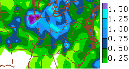
Scattered showers and storms may develop as the day wears on. There is a much better chance for scattered showers and storms developing this weekend. The models continue to increase the amounts falling across central and eastern Kentucky through Sunday night…
How much of an impact will those have on temps? I guess we shall see.
A cold front moves our way on Monday with a greater risk of showers and storms. This front may stall out across the region allowing for a few waves of showers and storms to move through…
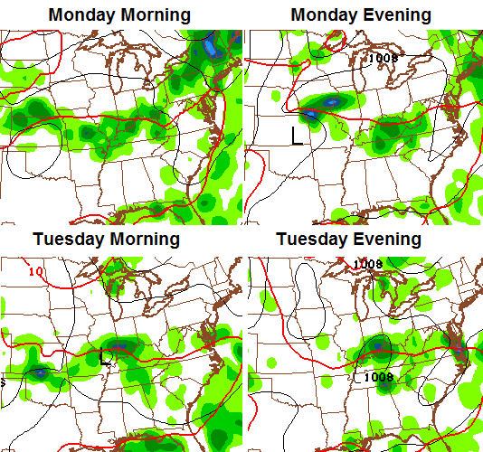
If that happens, some heavy rainfall numbers will be possible…

The overall weather pattern is one that looks fairly transient. That just means a lot of back and forth without any one pattern totally taking control.
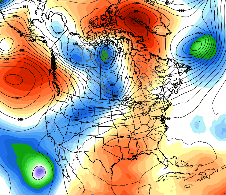
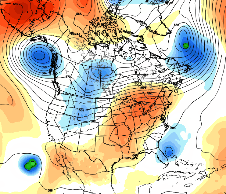
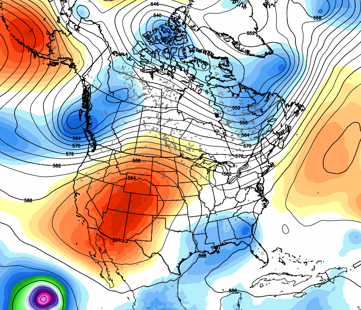
To prove the point, check out the upper level height anomalies.
This weekend:
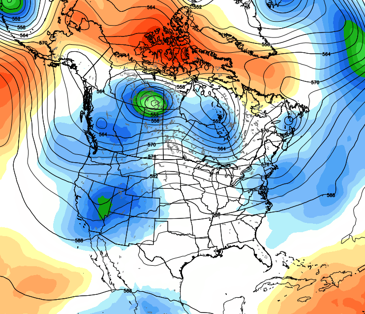
Tuesday of next week:
The following Saturday:
A few days later:
 That back and forth type of setup means the stormy pattern may not be going away anytime soon.
I leave you with a few tracking toys for the day…


Have a great day and take care.

Goodness gracious, storms just will not die around here will they?
A good old fashioned Bermuda High would be most welcome!
. no mention of flooding earlier today. went as far to say nothing like we saw earlier this week. well u can have a mulligan once in awhile..
Man -. It has been raining hard for a while now and storming hard in northwest Lexington.
If anyone in northwest Lexington in McConnell’s Trace or Masterson Station that has a rain gauge – I’d be interested to see how much rain has fallen. It’s been freaking POURING rain for an hour and the lightning and wind too…..
Here in south Lexington, we’re barely missing the storms that are just too north and south. It has now stormed and poured with the main line only. I’d estimate about 0.3 inchat my house, and likely 1 inch plus in northwest Lexington.