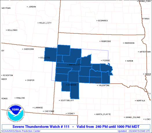
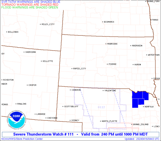
6:30pm UPDATE
A TORNADO WATCH is now in effect for much of central Kentucky until Midnight. Here is the outline map…
Here is a map to follow that latest warnings with…
Your radar views…
I will continue to watch the storms develop and update this blog as needed. I will also be posting updates in the comments section so check that out. You can also now follow the blog on twitter at http://twitter.com/Kentuckyweather
Help me out by post the weather where you are. Take care.
6pm Update
A new TORNADO WATCH is likely to be issued for much of central and eastern Ky. Here is where the SPC is watching…
I will update as needed. Take care.
Good evening gang. As expected… severe weather is moving across the bluegrass state and as a widespread severe weather event unfolds from the Ohio Valley into the deep south.
Much of western Kentucky is under a TORNADO WATCH until 9pm this eventing and we will likely see this watch issued farther eastward in the coming hours. Here is a look at the watch and the latest warnings…
We have all your radar needs to track the storms…
The entire state is now under a risk for severe weather into this evening. Here is the latest map from the Storm Prediction Center showing just how big of a severe event we are seeing…
The blog is now on Twitter at Kentuckyweather. If you have a twitter account… add us and you can get quick updates as to what I am doing and updates on the weather.
Stay with the blog for the latest severe weather information. I will update THIS post with any new watches and thoughts and will post updates in the comments section. Your eyes will be valuable to us as we want to know what’s going on in your hometown so help us out by leaving reports.
I am off from work today so I can devote my full time into the blog. Have a great evening and take care.
Select Page
Thanks Chris…keep us posted.
When I left work at Avon at 4:45 it was Sunny and 77 By the time got to I-64 3miles up it was thunder I then hit a batch of heavy rain and pea sized hail. The temp then went down to 64 all in about 5 miles or less I hope it won’t get any worse than that but I think this was just a little taste of what is yet to come. Be safe everyone.
🙁 I cant find you on TWITTER lol
http://twitter.com/Kentuckyweather
Checking for availability of this username …
new tornado watch just issued for most of us.
FIRE IN DA HOLE!!!!!!
mostly heavy rain with sum hail and gusty winds is what Rolo see a coming.
stay safe though.
Of course, so far nothing in Lexington but it has went from bright and sunny to cloudy and looks like it could rain any minute.
I live in Irvine and need to get my walk in will I have time before the storms hit?
I don’t know much about this twitter thing but I may try now that you are there. We old foggies have to be forced into thses things you know. Thanks for all the maps Chris. Looks like it will get to Madison County in a few.
Has anyone heard anything about what kind of weather Bowling Green is having?
Looks like the possibility of mainly very heavy (poss. flooding) rainfall, which will decrease the severeness of any storms, but there’s still a chance of a small tornado, so be on guard anyways,folks. Stay safe!
exactly what we don’t need we are still trying to dry out in Knox county
Strong thunderstorms are beginning to develop on the leading edge of the shower and storm shield. These are rolling quickly northeastward and could go severe at any moment.
Dogs are restless in Lexington…and they’re second only to Chris in severe weather predictions. Thanks, Chris, for keeping us informed.
Thanks for the twitter account info. 🙂 Just started following you. Thanks for the updates.
Do you see southeastern Ky such as Bell County or Knox County as getting any severe weather? TWC is saying that the main threat is heavy rainfall…
Very heavy rain/thunder in Bardstown right now. It got very cool/cold when it began.
Is this true? I hope that there is just heavy rainfall, i can deal with that!!
So far so good in terms of severe weather. We have no active warnings across the state. That could change and I will be watching it for you.
Thank youso much!!
Thanks Chris, Lets hope that this is just a rain event.
Just some lightning and thunder and a nice rain here. Windy, but not damaging. (SW Franklin Co.)
Lighting in Lexington, wind starting to pick up. On the second radar…what is the grey swirling thing over several counties?
Ground clutter is what causes it. Many possible reasons usually does not mean precip. over the area.
I hope everone stays safe tonight, please keep my family in your prayers, my grandmother passed away early this evening.
I went to moderation…..I hope everyone stays safe! Please add my family to your prayers, my grandmother passed away early this evening.
Whats a Twitter?
Nothing in Hazard yet.
Twitter is a social media site kind of like facebook and myspace. They call it microblogging. Basically short post like comments on here but limited to 140 characters. You follow people and then they update, you get their updates.
dj
Go to http://twitter.com it explains it fairly well. From what I understand it is very similar to communicate with friends. It is new to me also.
OOPS! I meant to say similar to instant messenging your friends.
Nothing in georgetown…
Nothing in Jeffersonville.
Just got a text that the tornado watch was canceled.
Geeeez MikeM…..even I know about Twitter! LOL! I just recently got a facebook page too! I’ve enjoyed finding old friends and classmates. Also a good friend I met on this blog! It’s fun!
Looks like everyone will be safe tonight, please keep my family in your prayers, my grandmother passed away earlier this evening.
Stuck in moderation
Me too chelle
Chris are you on MY SPACE TO???????
Sorry my cough med is starting to kick in lol.
CHRIS I meant to ask are you on FACEBOOK TO??????
Lots of heavy rainfall across central Kentucky right now. Drove 20 miles through it to get home, and it was difficult to see, to say the least.
Great overview. Your style of writing is really a joy to read.