Good Friday to one and all. We have a potent storm system rolling to you east today and this is being replaced by a much better brand of air. The overall setup as we roll through the next week or two is more common in late September than early August. If you’re a fan of pleasant temps… this is the pattern for you.
Our day will start with some clouds and some showers and drizzle in the central and east. Sunshine will slowly win the battle with afternoon highs reaching the upper 70s to low 80s. There is the slightest chance for low level moisture hanging tough in the east and keeping isolated showers going into tonight. Something to watch.
Saturday looks very nice with temps in the low and middle 80s for much of the region. Slightly warmer air will be across the west as skies stay partly to mostly sunny.
The threat for a shower or storm moves in on Sunday as higher humidity levels return. This action is ahead of a clipper looking system diving into the region early next week. That will produce gusty showers and a few thunderstorms and be followed by some absolutely awesome air…

That’s a very impressive looking system for this time of year, and it unleashes a deep trough to dig into the east. The European Model shows highs going well below normal again…
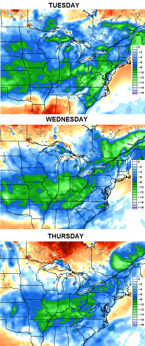 Highs on more than one occasion may not make it out of the 70s with lows in the 50s. I think we can handle that!
Winter talk comes your way this weekend. Until then, I leave you with some tracking tools…


Have a great day and take care.

Thanks Chris. Can’t ask for a better weekend to do anything outside! Today doesn’t look too shabby either! Was glad to see a but if rain as we were getting pretty dry here. The couple of inches we got was beneficial. Wishing everyone a happy Friday and a great weekend. Remember, we are just a few weeks from football!!!!!
Yes Coffeelady this type of weather makes you want to
“get ready to get ready” for football! Go Washington!
Chris,
Looking forward to those fall and winter models you spoke of early in the week.
Looking forward to the cooler temperatures. Almost as much as I’m looking forward to hearing about your fall/winter predictions.
Looking forward to this weekend’s winter talk and pleasant temps in the near term.
I love seeing those blues and greens on the temperature map!
Winter talk this weekend? AND the first preseason NFL game?? Fall is right around the corner, and I can’t wait for it’s arrival!
Please don’t use that W word anymore Chris. I’ll take 80’s year round.