Good Monday, everyone. We have an August version of a fall cold front moving into the bluegrass state and this will bring us a taste of September. To get to the nice temps, we have to go through a few rounds of showers and thunderstorms.
A few of the storms into this evening could be on the strong side with heavy rains possible. Your tracking tools in a bit. No, this is not a recording!
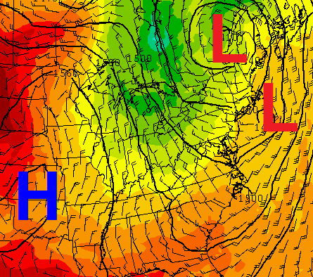
In looking at the setup, it’s almost as if there is a secondary system diving in behind the primary front. This arrives Tuesday and should be able to touch off a scattered shower or thunderstorm. That’s especially possible when one looks at the 850mb Relative Humidity levels…
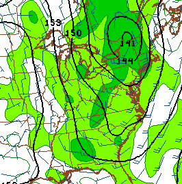
That’s normally something I look at during a northwesterly flow event in the winter. Highs on Tuesday will be in the upper 70s to low 80s ahead of the the push of even cooler and drier air. That arrives on Wednesday as winds come at us from almost the due north…
That knocks temps down even more for Wednesday and Thursday. Lows will be in the 50s with afternoon highs in the upper 70s.
There is a small chance for a shower or thunderstorm by Friday into the coming weekend as temps slowly bounce back up. Readings should still be slightly below normal during this time.
Let’s track today’s stormy weather…

Current watches

Possible watch areas 


Make it a great Monday and take care.

Woo hoo bring out the jacket Chris!