Good Tuesday, everyone. Our blast of September weather is blowing across the bluegrass state on this Tuesday as a strong cold front sweeps through. That will deliver some flat out awesome air for the rest of the week. Kinda ironic that we get nice weather just as the kids wrap up a soggy summer and head back to school.
There is still enough juice out there today for a scattered shower or thunderstorm as a secondary boundary presses in. Highs will still be in the upper 70s and low 80s with humidity levels still a bit elevated.
The cooler and drier air slowly pushes in from the north and northwest as the day wears on. Look at this flow setting up by Wednesday…
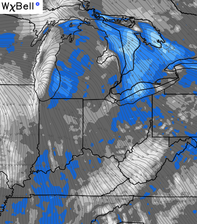
That’s almost a cool wind to go along with the very nice temps and a mix of sun and clouds. The high from Canada comes right into the region…

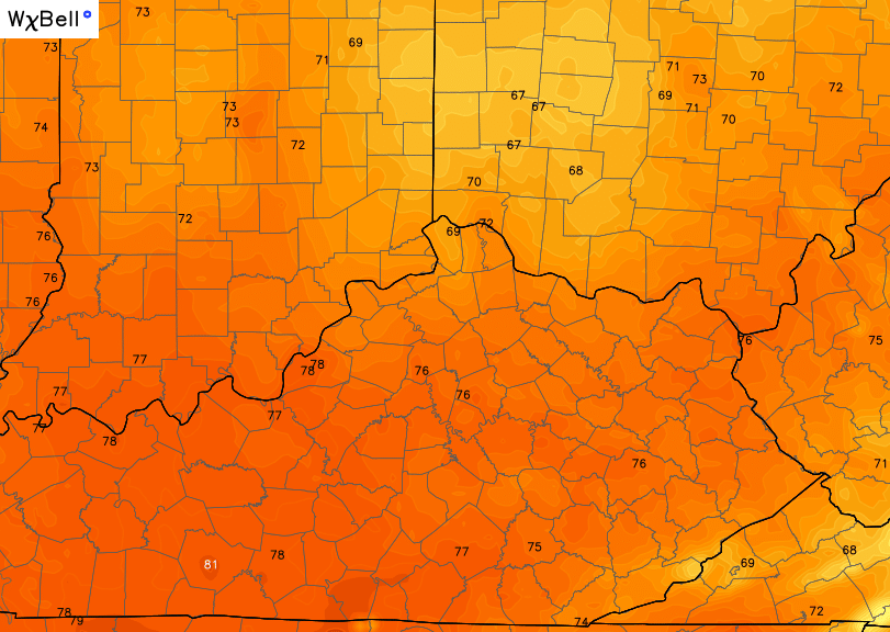
Wednesday afternoon high temps from the High Resolution NAM…
 Temps by the weekend will return to the low and middle 80s with the chance for a scattered shower or thunderstorm.
I leave you with a scaled down version of the tracking tools…


Make it a great day and take care.

Nice! I am starting to get ready for fall, but I want rush us straight to the cold either:)
I Ain’t tha 1 who likes it but it’s cool to Express Yourself if you’re that somebody that’s not happy If it Ain’t Ruff around here because you keep wanting something more severe 2 Dance 2 or Something Like That, then just give Chris Bailey a Little Quiet on the Set and maybe he’ll find you some weather that’s more Parental Discretion Iz Advised down the road.
(best I could do for yah CB before coffee).
Huh
July looks like maybe the 2nd strongest -AO on record apparently. Strongest ever was 2009..Believe last July had a very strong -AO also….If the warm pool continues in the NPAC along with a basin wide strong El Nino and a raging STJ ,,,going into winter should be interesting to say the least..Long way to go though..