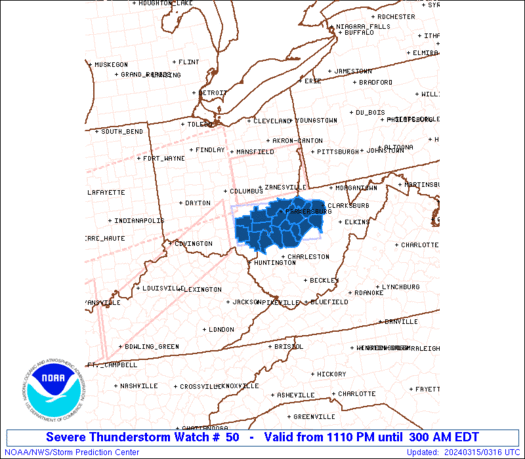
Good Sunday afternoon everyone. The threat for severe weather is increasing across Kentucky this afternoon into the evening. A TORNADO WATCH is now out for parts of central and western Kentucky until 8pm.
Here is the county outline…
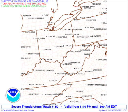
Here is a map showing the current warnings..
Radar…
I will have updates as needed and do some live blogging if need be so please check back with us. Enjoy your afternoon and take care everyone.
Select Page
Hello Chris, looks like we are in for a whild ride. Hope it doesn`t get too bad. But, i guess all we can do is hope for the best and be prepared for the worst. Stay safe out there everyone.
Hello Chris, looks like we are in for a whild ride. Hope it doesn`t get too bad. But, i guess all we can do is hope for the best and be prepared for the worst. Stay safe out there everyone.
Hello Chris, looks like we are in for a whild ride. Hope it doesn`t get too bad. But, i guess all we can do is hope for the best and be prepared for the worst. Stay safe out there everyone.
Hello Chris, looks like we are in for a whild ride. Hope it doesn`t get too bad. But, i guess all we can do is hope for the best and be prepared for the worst. Stay safe out there everyone.
Chris, are the chances good that the watch box will be extended to the east?
We’ve been talking about this for a few days. Don’t underestimate today’s weather. Everybody keep an eye on things today and stay safe.
NWS is asking for spotter help this afternoon and evening with this system!
Hi everybody. Looks like the weather is really trying to get it’s act together for a round of storms.
Chris, or Wxman, think that line has a chance to hang together long enough to cause any problems after while?
As you stated,Wxman, Chris has been on this for a few days now, and we all SHOULD be keeping an eye on that line of storms to the west, for sure! (And on the weather overall, as well.)
Chris DO you think the watch could end up being extended further east? Just wondering….
By the way, forgot to mention that it is 72 degrees here at this time.
it should hang together through dinnertime as it moves through the bluegrass after sunset with limted instabilty the line will weeken. the watch could be extended east the spc has not issued an MD yet on it. with the line winds to 80 mph some hail and a tornado warning or two.
the watch could be extended further east coffeelady, no word from the spc yet the line should reach lexington by dinnertime
Tornadoes on the ground w/that nasty cluster in Indiana now. Wind gusts of 80+mph w/ the line moving thru Western KY ATM..
Do you think Lexington will become part of the watch, Mitch? It looks like it could easily come our way.
the mountains will take care of eastern ky, always does.
BILLY G packing his bags!!!weeeeeeeeeeee thank god.
Don’t get excited, Rolo, He is only packing for Tampa later this week. 😉
On a weather note, that line of storms is looking like it wants to hold together pretty well. I am thinking that there is a possibility of some storms blowing through here after while. I just hope they stay below severe limits, if they do.
Mitch, if they do make Lexington by dinnertime, what about the Pulaski County/Somerset area? Your thought on the timing of that, if they hang together, please. Thanks
Looks like a couple of rogue storms are trying to form out in front of the main line that is out there. Lexington could see a stray before the line gets to you, from the looks of the radar.
The winds have been strong today, but now they are gusting. Extremely strong at times in Lexington.
I hear thunder already in Garrard County. Hmm….another rogue cell developing? Could get interesting around these parts….
BULLETIN – EAS ACTIVATION REQUESTED
TORNADO WARNING
NATIONAL WEATHER SERVICE LOUISVILLE KY
431 PM CDT SUN MAR 8 2009
THE NATIONAL WEATHER SERVICE IN LOUISVILLE HAS ISSUED A
* TORNADO WARNING FOR…
SOUTHERN HARDIN COUNTY IN NORTH CENTRAL KENTUCKY…
SOUTHWESTERN LARUE COUNTY IN NORTH CENTRAL KENTUCKY…
EASTERN GRAYSON COUNTY IN SOUTH CENTRAL KENTUCKY…
NORTHERN HART COUNTY IN SOUTH CENTRAL KENTUCKY…
* UNTIL 515 PM CDT/615 PM EDT/…
* AT 424 PM CDT…NATIONAL WEATHER SERVICE DOPPLER RADAR INDICATED A
SEVERE THUNDERSTORM CAPABLE OF PRODUCING A TORNADO NEAR PEONIA…
MOVING EAST AT 55 MPH.
* THE TORNADO WILL BE NEAR…
BONNIEVILLE BY 440 PM CDT…
UPTON AND SONORA BY 545 PM EDT…
MAGNOLIA…HAMMONVILLE AND 8 MILES NORTH OF LINWOOD BY 450 PM
CDT…
BUFFALO BY 555 PM EDT…
Chris
Do you see these storms dying out as they approach eastern ky or will they hold thier own in producing tornado warnings?
Light rain, sprinkles starting on & off here in W Franklin Co. No thunder yet. Temp 70
SEVERE THUNDERSTORM WARNING FOR GREEN, LARUE, MARION AND TAYLOR UNTIL 6:45PM.
New watch may be coming out soon! 🙂 http://www.spc.noaa.gov/products/md/md0213.html
In the old days a Tornado warning meant somebody actually spotted a Tornado on the ground. Is this still the case or are they issued by radar.
SEVERE THUNDERSTORM WATCH
Severe Thunderstorm Watch
SEVERE THUNDERSTORM WATCH OUTLINE UPDATE FOR WS 51
NWS STORM PREDICTION CENTER NORMAN OK
625 PM EDT SUN MAR 8 2009
SEVERE THUNDERSTORM WATCH 51 IS IN EFFECT UNTIL 1100 PM EDT
FOR THE FOLLOWING LOCATIONS
KYC001-005-011-017-021-023-037-045-049-053-057-065-067-069-073-
079-087-097-109-113-125-135-137-151-155-161-165-167-169-171-173-
181-191-197-199-201-203-205-207-209-217-229-239-090300-
/O.NEW.KWNS.SV.A.0051.090308T2225Z-090309T0300Z/
KY
. KENTUCKY COUNTIES INCLUDED ARE
ADAIR ANDERSON BATH
BOURBON BOYLE BRACKEN
CAMPBELL CASEY CLARK
CLINTON CUMBERLAND ESTILL
FAYETTE FLEMING FRANKLIN
GARRARD GREEN HARRISON
JACKSON JESSAMINE LAUREL
LEWIS LINCOLN MADISON
MARION MASON MENIFEE
MERCER METCALFE MONROE
MONTGOMERY NICHOLAS PENDLETON
POWELL PULASKI ROBERTSON
ROCKCASTLE ROWAN RUSSELL
SCOTT TAYLOR WASHINGTON
WOODFORD
A tornado warning is an alert issued by government weather services to warn an area that a tornado may be imminent. It can be issued after either a tornado or funnel cloud has already been spotted, or if there are radar indications that a tornado may be possible.
Hello Chris, looks like we are in for a whild ride. Hope it doesn`t get too bad. But, i guess all we can do is hope for the best and be prepared for the worst. Stay safe out there everyone.
Hello Chris, looks like we are in for a whild ride. Hope it doesn`t get too bad. But, i guess all we can do is hope for the best and be prepared for the worst. Stay safe out there everyone.
Hello Chris, looks like we are in for a whild ride. Hope it doesn`t get too bad. But, i guess all we can do is hope for the best and be prepared for the worst. Stay safe out there everyone.