Good Thursday to one and all. Showers and thunderstorms continue to deliver a nice drink of water to the bluegrass state. We have one more wet system ahead of us, but this one will be a littler different. It’s being pushed by a true blast of late October air. There’s a little Brr in the weekend outlook!
Showers and storms will slowly taper off from northwest to southeast this afternoon and evening. That drying trend doesn’t last long as a strong cold front drops our way from the northwest on Friday. Winds will really gust up as showers and storms develop in the afternoon and evening. This could cause some issues at for area high school football games.
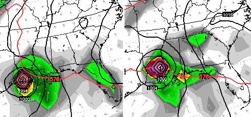
The front moves in here Friday night as low pressure develops across the Tennessee Valley. That low then really cranks up just to our east on Saturday…
NAM
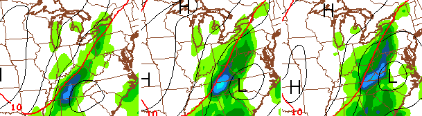 That would mean Saturday could feature gusty winds, a few showers and chilly temps. The models then really crank that storm up just to our north and east through Sunday…
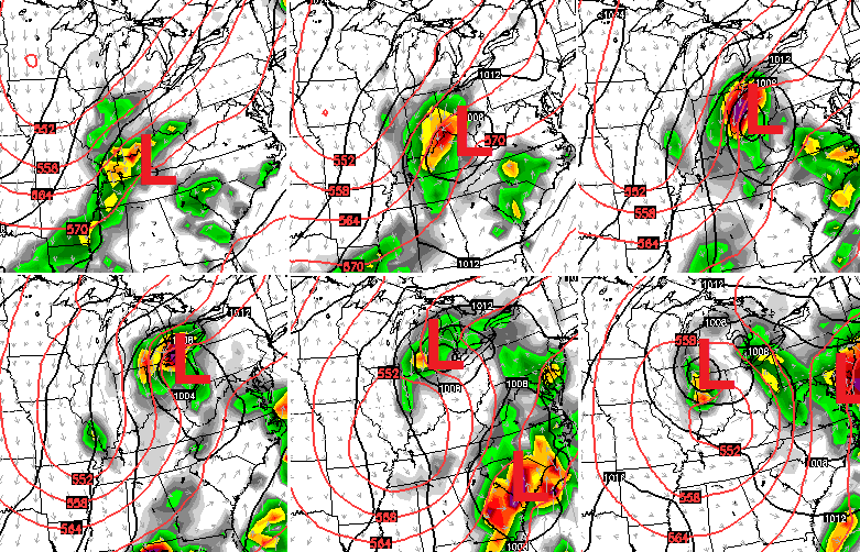 That’s one wild look for September. Something like that from November on would have us in Alert mode and I’m not talking about the current Pot Of Chili Alert! 😉
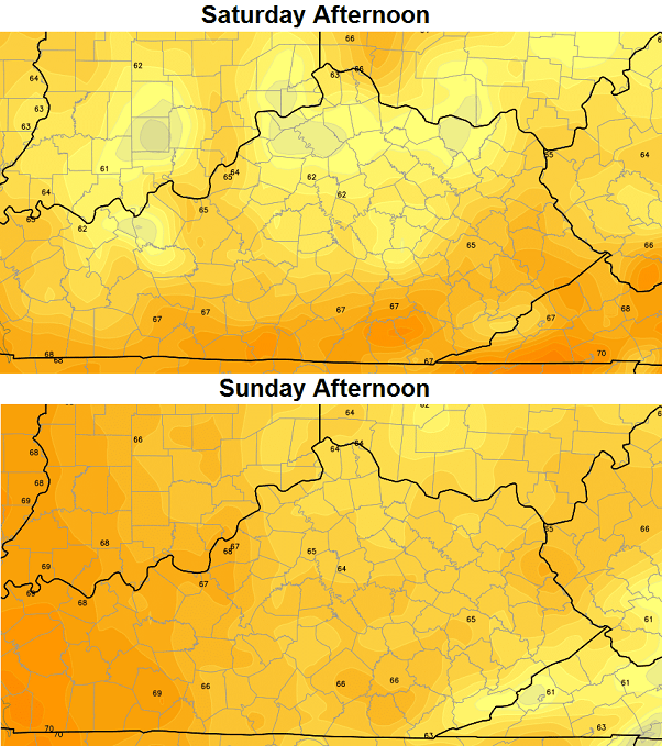
Highs temps for Saturday and Sunday are way below normal on the models…
 If skies can clear out for the morning hours on Sunday and Monday… look out. Readings can really tank and the GFS is going to the extreme…
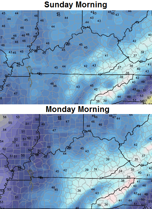 That’s likely to be TOO cold, but is still impressive to see this early in the season.
Nice weather continues into early next week with a slow moderation in temperatures by the middle of the week. A lot of how next week unfolds may hinge upon what happens in the Gulf. The European Model continues to develop a big tropical system down there…
 I leave you with your storm tracking toys…


Have a great day and take care.

Just as I expected, over half of Kentucky is in the ‘abnormally dry’ shading. This does not mean California drought status…think of it as a pre-condition for short term drought.
However, some locations got in on enough rain to wipe away this pre-condition. I got almost 1.00″ (0.98″ to be exact) since yesterday. I have read about some locations with 2-4″ though.
Amazing how quickly things dry out here. Even for the year we are much above normal and the rains that came have been more isolated that widespread. We had heavy rain in Lex yesterday from one big shower but that was it…Frankly, I’m NOT surprised because it’s either one extreme or the other around here with weather.
I got a feeling we’re gonna be sick of chili by the time March arrives…lol
Try home made soup. 😉
I doubt we will get a mid September frost as indicated above; however, it is still impressive cold for this time of the year. If we make down to 40F, I will be impressed indeed for so early in the year!