Good Saturday, folks. We are in full blown Pot Of Chili ALERT status as a late October air mass invades the bluegrass state. This is bringing some very chilly air and the threat for some gusty showers out there today. It may even feel the September version of blustery at times.
Low pressure develops to our east will throw some steady rains across the east early today. As the big pool of cold air aloft moves in, gusty showers and a even a storm develops. Soft hail is even possible in this type a setup. Temps will mainly be in the 60s with a quick drop once the sun sets.
High pressure moves in for Sunday and Monday as the low moves off to our northeast…
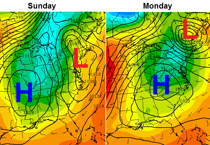
With that high moving right on top of the region, overnight lows can really tank. The closer we get to the next few mornings, the colder the look on the models…
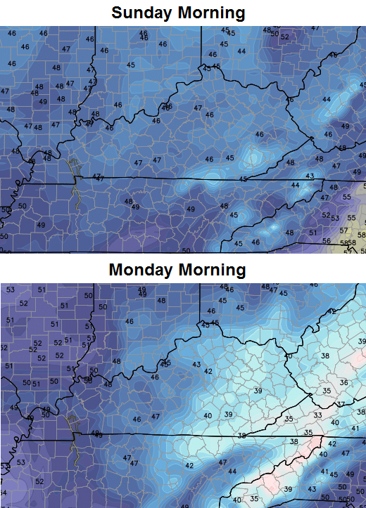
That’s some chilly stuff and could threaten a few record lows. It’s very possible to see the first upper 30s of the season in some of the colder valleys.
Highs on Sunday will be back in the 60s with low 70s returning for a magnificent Monday. That high won’t get too far away from us next week as it slides just to our east…
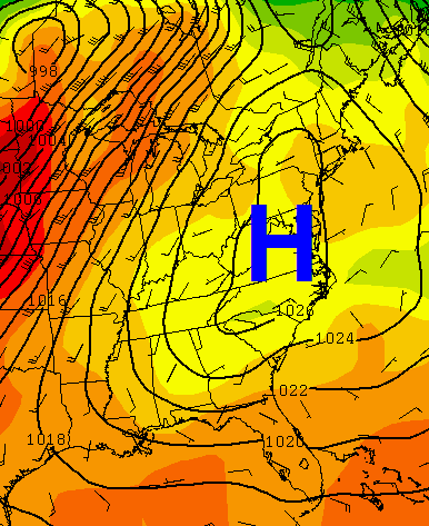
Cool nights and mild/warm afternoons should be the norm through Thursday. Another front approaches the region by next weekend with our next chance for showers and storms.
Speaking of showers and storms, let’s do some tracking of what we have out there today…


Make it a great Saturday and save some chili for me! 🙂
Take care.

Thanks Chris for what you do every day. I appreciate it.
Thank you Chris. The weather is bound to change. After all this is Kentucky. And you are always right there to keep us informed. Thanks again. Happy Saturday everyone and GO CATS and Blue Raiders!!
Got the chili started! And from the looks of the shelves in kroger last night, a lot of folks are making chili. Enjoy!
Thanks Chris for the update. Here’s to hoping that Lawrenceburg and Anderson County can get some rain from the showers today. We’ve managed to escape every bit of any organized activity with every rain event since late August. Almost everywhere else got at least a decent shower or two and in many cases a lot more!
Ready for this fall chill to stay!
Try coming to Harlan Co. where all of the good weather (meaning storms, rain, winter systems) misses, with the exception of some of the snow this past winter–finally:)
Well CB is influencing what is being bought in the grocery stores already before winter weather forecasts begin:) Now, I wish I would have picked up some bean-o yesterday before consuming the chili today:]
Been hearing winter prognosticators calling for a winter snow dome for the tristate due to El nino. What do you think Chris?
http://www.bbc.com/news/science-environment-34236010
Right on cue CB, saw your tweet a moment ago and have the fire pit aglow…marshmallows a roasting, my little girl is loving it. And the wind is finally calming down too.
Sat around the fire pit today with the family. And, of course, a big pot of chili was enjoyed by everyone! Loving this taste of fall weather!