Good Thursday, folks. We’re rolling our way toward the weekend and we have a cold front rolling its way toward the bluegrass state. That system may kick off more of an unsettled pattern across much of the eastern part of the country.
Our cold front arrives Saturday afternoon and evening with a gusty band of showers and thunderstorms just ahead of it…
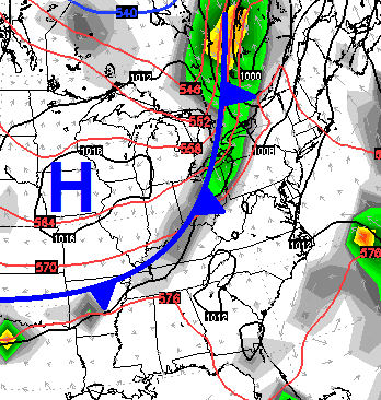 Temps will drop quickly behind that front with upper 40s and low 50s showing up by Sunday morning. Afternoon highs will be in the pleasant low and middle 70s.
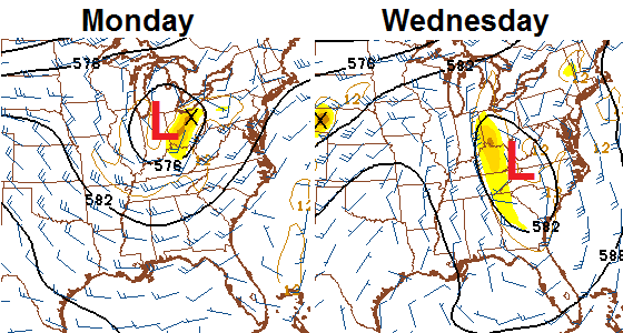
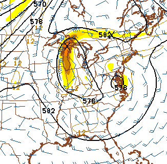
That sets the stage for a possible unsettled period showing up next week. An upper level low may develop across our region and hang around for much of the week…
 If that happens, periods of showers and thunderstorms would be possible. Winds would also be rather gusty with normal to slightly below normal temps.
The models actually try to keep that thing around into NEXT weekend…
 The new JAMSTEC seasonal model is out and continues to show a colder than normal winter for our part of the world. It’s interesting in the same model is also showing above normal precipitation…
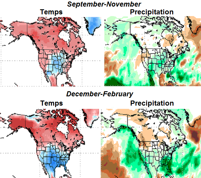 That model sure looks like it wants to develop some healthy storm systems in the Gulf of Mexico and roll them up the east coast. Hmm!
Have a great day and take care.

winter is looking good for us snow lovers so far.
I guess we need the rain.
Looks like a strong El Nino with an active STJ..If the warm waters can continue to shift west could be interesting this winter..Uncharted territory with this Nino..
I continue to agree with CB’s models and will not give in to some of the other local meteorologists that are trying to hammer home a mild, dry winter. The old timers usually follow signs such as heavy fruit on apple trees, thick fogs in summer/early fall, black wooly worms, etc., etc., and these signs are all here just like last year!
I’ve been out on the riding mower pushing the weeds down and the dust up. I’m sure my sinuses will thank my tonight.
I sure do like the looks on that model! Eye candy for winter weather lovers for sure. It would certainly be something to have 3 memorable winters in a row!