Good Friday to one and all. We’ve made it to the end of an absolutely gorgeous weather week in Kentucky, but changes are blowing in for the weekend. This looks to be the beginning of a little bigger change as an upper level low develops near our region into next week.
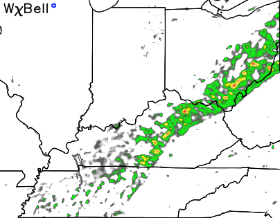
Our weekend cold front is still on tap to arrive late Saturday afternoon and evening. This boundary will bring a broken line of showers and thunderstorms across the state. Here’s the early Saturday evening simulated radar from the Hi-Res NAM…
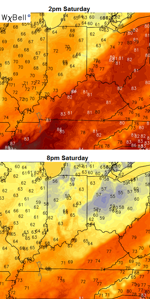
 Winds will be very gusty as the front moves through and our temps should drop pretty quickly. You can see just how quickly on the same model run…
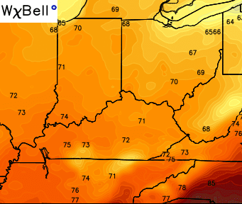
 Much cooler and drier air moves in for Sunday on a gusty wind coming in from the north. Afternoon high temps may not get out of the low 70s for some…
 Sunday is looking more and more like one heck of a weather day!
Monday morning temps will drop into the upper 40s for many with afternoon temps in the low and middle 70s. Moisture will increase to our south and I can’t rule out a stray shower or storm.
The overall setup for next week still looks rather unsettled for Kentucky and much of the region. A big upper level low is forecast to get cutoff from the main flow. That often leads to a slow moving system that hangs around for days. The GFS continues to indicate this thing getting stronger in time…
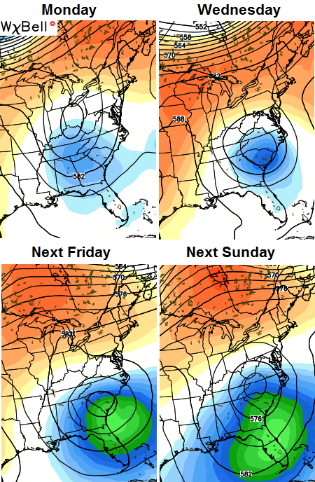 That would lead to normal or slightly below normal temps around here with a daily threat for a shower or thunderstorm. If the models are correct, that forecast could hang tough through NEXT weekend.
Have a great Friday and take care.

I hope ALL AREAS get some rain next week in a more equal fashion. The summertime butterfly rain pattern usually ends after September. I am tired of seeing some get 4 inches of rain while others barely get a trace. Plus, we will need to start getting a little rain at least once a week or we could have a nasty forest fire season with all of the veg a little latter this year!
I am suppose to be driving to Frankfort sat and be outside from 10 to 5, I have looked at 3 diff weather forecasts for frankfort and all 3 are diff, so my question is how wet will I get while there! Lol. Thanks
This weekend will be good enough to watch the cats beat uf in football for the first time since i was a kid. Also it will be good weather for BBQ, smoke it yourself or support one of the local BBQ places.
Any hopes of snow on the pumpkin?
If we don’t get some rain soon in Anderson County, you might as well call the area blow torched. It’s really sad to see these lawns. I can’t imagine what things might look like if we go another couple weeks with no measurable rain.