Good Tuesday, everyone. Things continue to run on the quiet and awesome side across the good ole bluegrass state of Kentucky. Pleasant temps and mainly dry weather rolls on for much of the week. That said, we have to watch the setup along the east coast and then into the Gulf of Mexico.
There isn’t much more that can be said about the stuff over the next several days… Enjoy it.
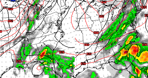
A huge area of high pressure across New England and an area of low pressure off the southeast coast continue to be the dominant play makers.
The models are all over the place with exactly how they want to handle the low. A few bring drift it around for several days with little impact on our weather. A few others, like the Canadian, show moisture from that low being pushed all the way into our region by Friday…
 The GFS is also showing the threat for some showers reaching Kentucky by Friday and into the weekend…
 There’s a little bit of chaos theory involved in a setup like the one along the east coast, so we just have to see how it plays out.
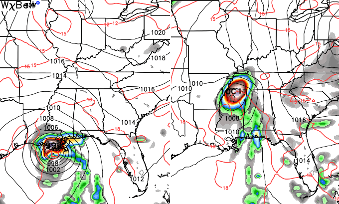
The Gulf of Mexico continues to be the medium range focal point for the potential of tropical development. The GFS shows a system developing in the Gulf and then getting pushed to our east by a cold front passing through…
 The Canadian Model does not have the cold front and allows any system to lift due north…
 Interesting times showing up as roll through the remaining days of September and into early October. As a matter of fact, this month is giving me some honest to goodness analogs I can finally take a look at. I will share some of those with you later this week.
Enjoy the day and take care.

Pulling for the Canadian model. I’d love to have some soaking rains on my parched food plots.
Things are going to have to change or the drought mongers will rise again:)