Good Wednesday, everyone. Fall arrives today on a very nice weather note across the commonwealth of Kentucky. Gorgeous skies and pleasant temps usher in the new season. This nice weather is going to try to give way to some rain by late week and into the weekend as the weather shifts into reverse.
The setup along the east coast has not changed. We have a big sprawling high pressure across New England with a deep low pressure off the southeast coast. Both are kind of stuck in place, but the overall flow may push moisture from the low westward into our region.
Many of the forecast models are now trending in that direction. The NAM is now the most aggressive with the initial showers on Friday…
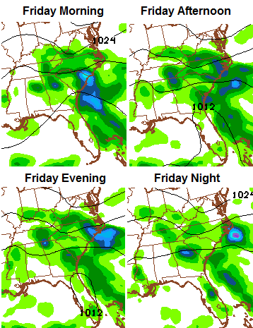
 If that’s correct (still a big if), some decent showers move in with temps staying in the 60s for Friday.
The European Model is similar…
 The same model over the weekend…
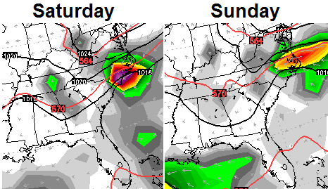 The Canadian Model continues to offer decent rains. Check out the numbers through Monday…
 Again, this is a fluid setup that can change from day to day. As of now, the chances for some rain are on the increase.
Looking into next week, the models are still developing a tropical system in the Gulf of Mexico, they just have no idea on what to do with it.
One thing showing up a little more on the models is a potent cold front around the middle of next week…
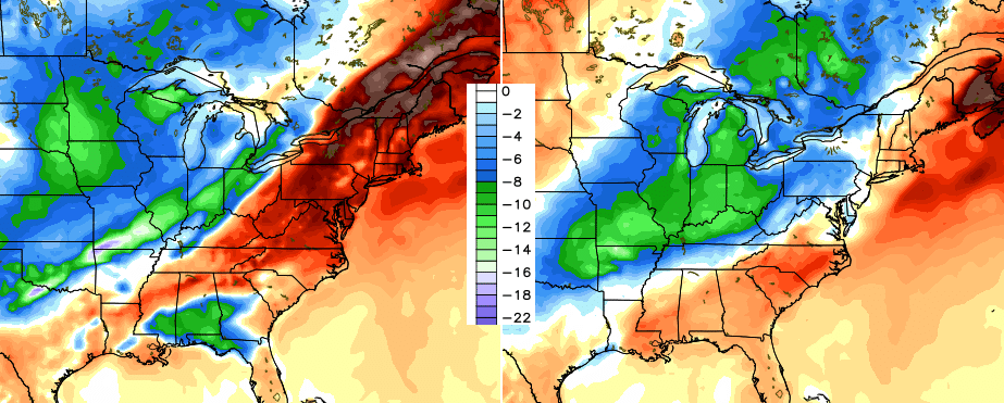 That front would obviously have a big say in what happens with any kind of system developing in the Gulf.
Have a great day and take care.

Happy Fall…now 3 minutes old.
61 degrees at Lexington Mesonet (4:00 a.m.)
Lexington BG at 55
Harrodsburg Mesonet at 54
Guess what I’m writing about next in part two of my analyses of Lexington’s temperature readings? And it won’t be about the sensor at BG airport.
61 degrees…It’s 63 at the heat capital of America in Louisville International and 60 at Bowman Field in Louisville
Well I agree that this indicates the censor at Lex Mesonet has an issue as well. Perhaps they both have issues? Or at least BGA did a few weeks ago but I do not know if this was fixed?
but what about all the other times when the same could have been said for the BGA censor? It was in the 60s everywhere but the BGA censor.
Consistently LexMes is among the warmest at night and coolest during the day for its region that includes Harrodsburg, Winchester, and Frankfort Mesonet sites along with NWS official sites of Lexington and Frankfort
Thanks Chris. We really do NOT need any systems in the gulf of Mexico…especially next week and through to the next one. That is our week in Florida, and I really don’t want to spend it looking out at it raining on the beautiful Atlantic ocean! As for some rain here, that would be welcomed, at least at our house. We have not had measurable rain for nearly two weeks now, and its getting pretty dry. Fall fire season is about to hit and if we don’t get some rain, it could be bad. I can’t honestly say I’ve been mad about the beautiful weather we’ve been having, but I do realize we need a balance to get those gorgeous fall colors we all love. Have a great hump day everyone!
I bet more than a few did a double-take when they read that precip is coming from east to west. 😛
Thanks CB for keeping us informed, even those of us that are outside Kentucky!
Hey guys get your own rain gauge and thermometer like I have the heck weather the airport or whomever is off. Nobody is perfect!!
Well it is definitely going to rain in Harlan Co. As I was walking a few minutes ago, the smoke from a fire on a hill was descending into the valley which means sinking air. Usually when smoke descends, the pressure is lowering and rain will follow within 48 hours. I learned that old saying from my grandmother! It has always held true:)