Good Sunday, everyone. September is quickly running out of days and our overall weather pattern continues to look pretty darn active. This should really kick into high gear once we flip the calendar into October as signs are pointing toward a busy period.
Our Sunday will feature a mix of sun and clouds with isolated showers and thunderstorms going up. Temps will hit the mid and upper 70s with a humid feel to the air.
That same humid feel will be with us on Monday as juice begins to work in from the Gulf of Mexico. That’s where a developing tropical system is trying to get going. Some of the latest data suggests we will need to watch for a shower or thunderstorm going up…

As I mentioned in my last post, the Gulf system is fighting with itself and may not really get cranking before coming ashore on Tuesday. Some of that moisture is likely to be pulled northward into Kentucky as a cold front drops our way from the northwest. Showers and storms will increase on Tuesday…

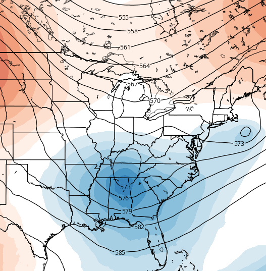
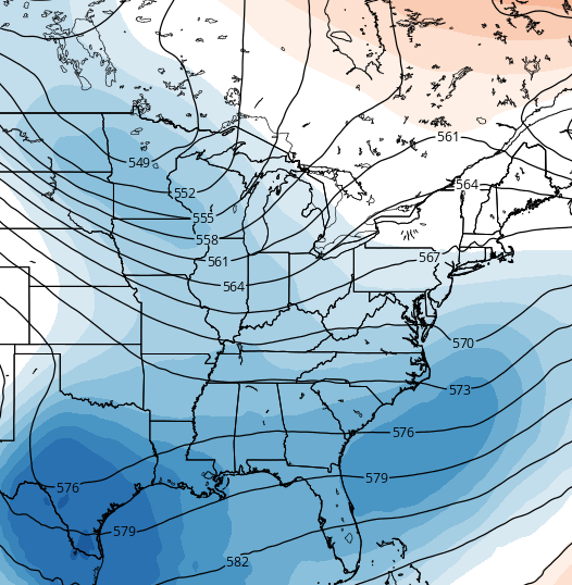
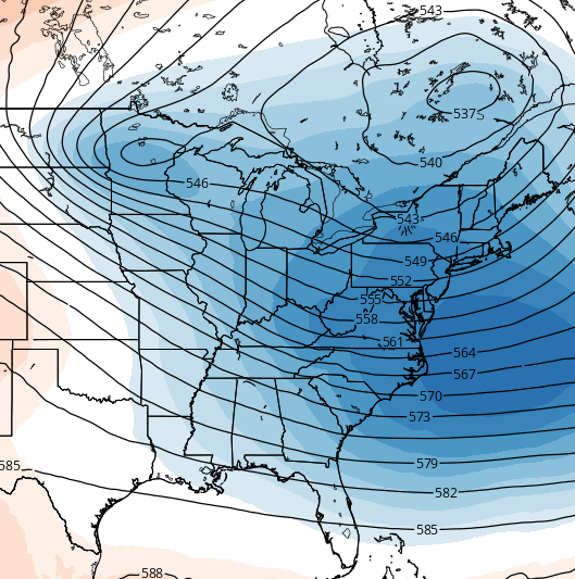
All of this is likely to come together and form another big east coast low. This storm has the potential to really deepen just to our east by later in the week into the coming weekend. It should also be another slow mover that can throw additional rains back our way. Here’s the setup to watch for…

That’s another huge blocking high across southeastern Canada and the northeast. The kicker in all that is another system is dropping in from the west and northwest.
Odds do favor cooler than normal temperatures developing around here and across much of the country by late week into the weekend…

Lately, I’ve been trying to pump up the volume on the potential for an interesting October. The indicies are strongly pointing toward a very busy pattern…
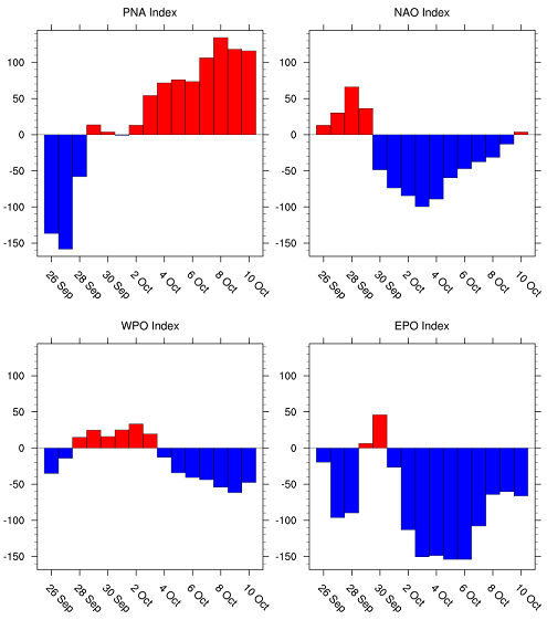 A positive PNA with a negative NAO, WPO AND EPO is certainly an attention getter. That’s a combination that argues for colder and stormier conditions across the eastern part of the country. Winter fans would love seeing that setup in another month or two.
Right on cue, the models are developing some pretty big dips in the jet stream over the next few weeks…
It’s another year in which the party could get started earlier than normal!
I may have another update later today so check back. Make it a good one and take care.

I wonder if later this winter if the blocking pattern and current dominating strong northern jet will help to keep moisture from the developing El Nino’s strong southern jet further south than usual or if we will get a lot of “bombing” of the storms as the two jet stream come together, if that happens. I know, a lot of ‘ifs’ here. What do you think CB or anyone else?
I hope we can get some additional rains from all of this. But I’m also being selfish and hoping for decent Fall Break weather from October 4-11…especially in WV and VA where our road trip is taking us!
I’m selfish as well. I want good weather in Fla, as we are headed that way on Thursday. We got pretty good rain on Friday/Saturday AM. Now want less clouds tonight so we can see the. Super moon and eclipse. Fingers crossed! Thanks Chris for the update.
Finally got some rain drops here in western ky. Just enough to settle the dust down .
So we may not see the super moon eclipse? 🙁
Lots of clouds are causing a hazy outline of the moon at the moment