
Good Friday, folks. A blast of real deal chill is arriving right on schedule and will likely end the growing season this weekend. Temps will take a huge tumble and should give our region the first taste of the 20s this fall.
This air is coming in behind a cold front sweeping to our east and southeast today. Winds will be very gusty as the colder air moves in. Readings this weekend will be on the cold side with frost and freezing conditions likely. The latest computer model forecast for lows…
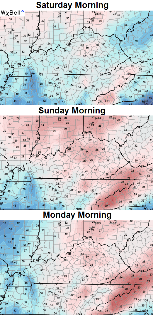
Allergy suffers have got to be absolutely loving those numbers!! Outside of the cold, the weekend weather looks fantastic with mainly clear skies.
Temps rebound into the first half of next week, but another cold front will likely move our way by the end of the week. That front should bring a band of showers and thunderstorms our way…
Something tropical may very well try to develop in the Gulf of Mexico. The above front or a front coming in behind that one MAY try to pick up whatever develops there. Some interesting looks are possible over the next few weeks.
Speaking of interesting, check out the European Extended Ensembles snowfall forecast for the next month…
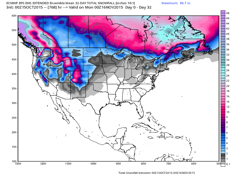
Now, I don’t put much stock in that, but it suggests another very early taste of flakes around here. As always, we shall see.
I will have some winter updates over the weekend. Make it a great Friday and take care.

Thanks, CB, for the update. Bring on the early cold!
this winter should be very interesting with the strong el nino and second half of winter heavy snowstorms and.cold because of weakening el nino and con. polar vortex over Canada as well as warm water off of alaska.
Bring on the cold.
Yes, there is finally the heavenly fragrance of firewood smoke in the air! Now it is really really fall 🙂 .
All of Kentucky and much of Tennessee (including Nashville) under Frost Advisories. My wife and I have covered up the outside ferns and other plants to hopefully extend their lifes beyond the next few cold nights.