Good Monday, folks. Gorgeous fall weather continues across the bluegrass state and the best is yet to come. The fall colors are getting close to reaching their glorious peak and mother nature is throwing us some amazing weather to boot. While the week is a nice one, all eyes are on the weekend and next week for some potential huge changes.
Chilly mornings and mild afternoons dominate the weather from Tuesday through Friday. Winds are going to be very gusty at times, so let’s keep a close eye on the forest fire situation. It’s that time of the year.
The pattern after Friday will be dictated by what happens with the tropics. That goes for the Gulf and Atlantic… and out in the western Pacific. What happens there also has big implications on the downstream pattern across North America.
Several of the models continue to try to develop something down in the Gulf of Mexico as a cold front approaches our region from the northwest. The Canadian model has been the most consistent with the upcoming weekend potential…
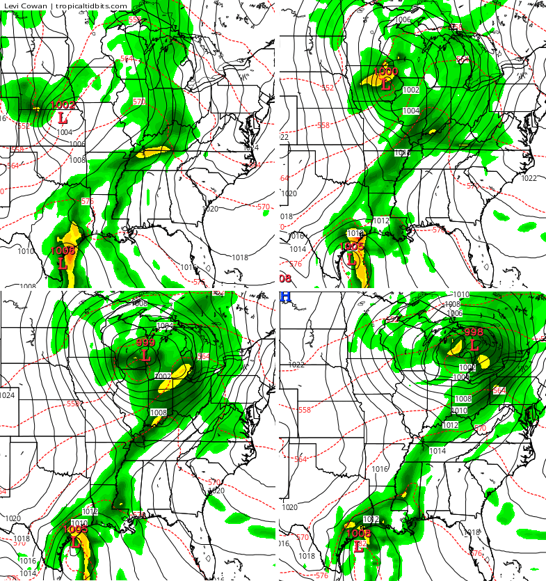
That front only brings up some moisture with whatever system we find coming from the Gulf. Instead, the model then waits for a deepening trough to pick it up…
That then goes on to turn that system into a healthy low going up the east coast with a nice cold shot coming behind it into our region…
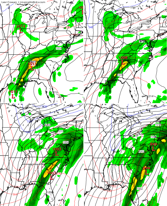
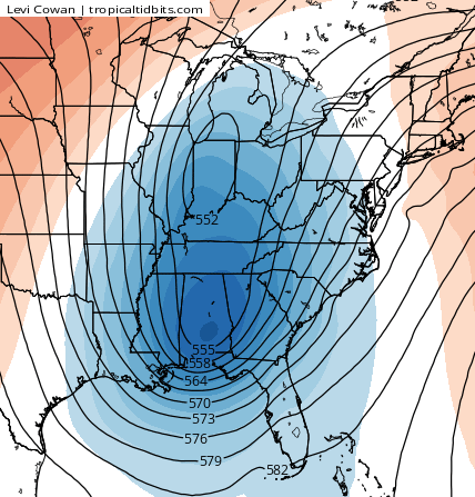
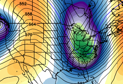
Again, this is a rather low confidence pattern until we can figure out what happens in the tropics. Once I get a better handle on that, things will become much clearer. Some interesting options are on the table for the last week of October. The GFS Ensembles are trying to sniff out a deep trough during that time…
 Have a great Monday and take care.

Crisp, starry morning. Venus and Jupiter showing off in the east sky. According to my Distant Suns app, Mars is right there where Jupiter is, but unless I dig out my telescope, I really can not see it well.
It looks real interesting going ahead. Maybe some upper level cold air in this area with deep trough possibly moving in next week. Thank you Chris we shall see.
Chris I am a weather nut ever since I was six years old. Use to follow tom wills in the seventies. Weather is in my blood. Love your accurate forecasting it is a science for sure. Have a good day.
I see the snow line into Tennessee on the last GFS run at the bottom. Guess there’s still some hope for our October snow streak. If we get flakes in October will this be 4 straight years or 5?
We should have a pool – who can predict which school system is the first to call a snow day and when. My money would be on Leslie or Jackson for Thursday, 10/29.
Knox
Chris,
I just thought you’d like to know….your snowfall forecast predictions are making the rounds on FB and are being used without your permission to cause unnecessary “panic.” Ppl with too much time on their hands.
Has Chris put out a snowfall prediction yet?
No that doesn’t come out till Thanksgiving.
Freeze in Harlan (valley) this morning at 29 degrees…this is in the valley and not by the Mesonet…what I actually recorded. The kudzu vines, elephant ears, and most greenery took a hit!